Dawson Springs in Hopkins County, Kentucky — The American South (East South Central)
Dawson Springs
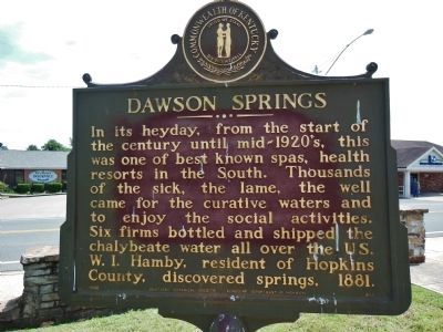
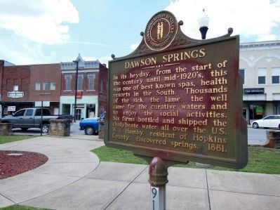
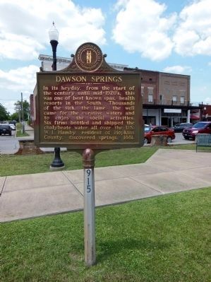
In its heyday, from the start of the century until mid-1920’s, this was one of the best known spas, health resorts in the South. Thousands of the sick, the lame, the well came for the curative waters and to enjoy the social activities. Six firms bottled and shipped the chalybeate water all over the US. W. I. Hamby, resident of Hopkins County, discovered springs, 1881.
Erected 1966 by Kentucky Historical Society and Kentucky Department of Highways. (Marker Number 915.)
Topics and series. This historical marker is listed in these topic lists: Entertainment • Government & Politics • Industry & Commerce • Settlements & Settlers. In addition, it is included in the Kentucky Historical Society series list. A significant historical year for this entry is 1881.
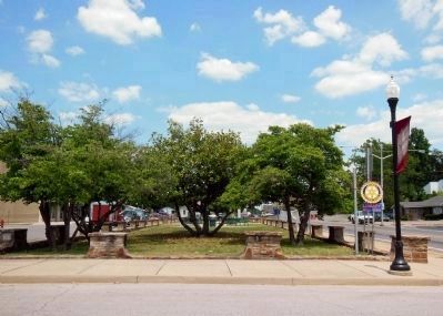
Location. 37° 10.064′ N, 87° 41.529′ W. Marker is in Dawson Springs, Kentucky, in Hopkins County. Marker is on U.S. 62, 0.1 miles east of South Main Street, on the right when traveling west. Marker is located within the town center plaza bordered by Veterans Street, Arcadia Avenue, Main Street and Railroad Avenue. Touch for map. Marker is in this post office area: Dawson Springs KY 42408, United States of America. Touch for directions.
Other nearby markers. At least 8 other markers are within 12 miles of this marker, measured as the crow flies. Skirmish at Grubb's Crossroads (approx. 8.7 miles away); Ranger Leader Blinded (approx. 8.7 miles away); U.K. Research and Education Center (approx. 10.4 miles away); Site of Dotson School (approx. 11 miles away); William Prince, 1752-1810 / Founder of Princeton (approx. 11.2 miles away); a different marker also named William Prince (approx. 11.2 miles away); Shandy Hall (Princeton) (approx. 11.2 miles away); County Named, 1809 (approx. 11.2 miles away).
More about this marker. The marker is somewhat weathered but still legible.
Also see . . .
1. Dawson Springs Early History. City website entry
Thus came into being Dawson’s first mineral “spring,” the famous Chalybeate Well No. 1, on June 7, 1893. Later, while boring for water for a hotel he had built, Mr. Hamby again accidentally struck an inexhaustible stream of water. The famous well became known as Hamby’s Salts, Iron and Lithia Well. The discoveries of these two wells would change the course of history for the city. (Submitted on November 27, 2014, by Cosmos Mariner of Cape Canaveral, Florida.)
2. Chalybeate Waters. Wikipedia entry:
Also known as ferruginous waters, they are mineral spring
waters containing salts of iron. (Submitted on December 11, 2023, by Larry Gertner of New York, New York.)
3. Dawson Springs, Kentucky. Wikipedia entry
Originally known as Tradewater Bend, the city was incorporated in 1832 under the name Dawson City by two Menser brothers. From the late 1800s to the 1930s, Dawson Springs was well known as a spa and resort town. It is still popular as a tourist destination because of the Pennyrile Forest State Resort Park and nearby lakes and hiking trails. (Submitted on November 27, 2014, by Cosmos Mariner of Cape Canaveral, Florida.)
4. 61st Governor of Kentucky. Wikipedia entry
Steve Beshear, 61st Governor of Kentucky since 2007, was born in Hopkins County, Kentucky on September 21, 1944. He was raised in the small town of Dawson Springs, where his father owned a furniture store, operated a funeral home, and served as mayor. Beshear served in the Kentucky House of Representatives from 1974 to 1979, was the state's Attorney General from 1980 to 1983, and was the 49th Lieutenant Governor from 1983 to 1987. He is not eligible to run for re-election again in 2015 due to term limits established by the Kentucky Constitution. (Submitted on November 27, 2014, by Cosmos Mariner of Cape Canaveral, Florida.)
5. Dawson Springs History. Hopkins County website entry:
The town of Dawson took its name from the family that purchased the 250-acre
Photographed By Cosmos Mariner, June 7, 2012
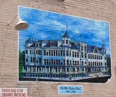
3. New Century Hotel (1902-1960)
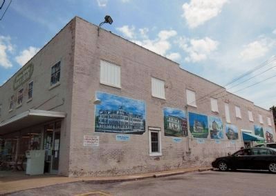
In the early 1900s Dawson Springs was home to what was described as the most fabulous showplace in Western Kentucky, the New Century Hotel. Among the hotel's many attractions were running water, steam heat, a ballroom and three-piece Italian orchestras. A new wing was added to the hotel to accommodate the Pittsburgh Pirates when they came to Dawson Springs for spring training from 1915 to 1917. Other teams, such as the Cincinnati Reds, also chose the town for training.
Credits. This page was last revised on December 11, 2023. It was originally submitted on November 26, 2014, by Cosmos Mariner of Cape Canaveral, Florida. This page has been viewed 1,854 times since then and 110 times this year. Photos: 1. submitted on November 26, 2014, by Cosmos Mariner of Cape Canaveral, Florida. 2, 3, 4, 5, 6, 7, 8, 9. submitted on November 27, 2014, by Cosmos Mariner of Cape Canaveral, Florida. • Al Wolf was the editor who published this page.
