Fort Washington in Prince George's County, Maryland — The American Northeast (Mid-Atlantic)
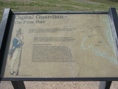
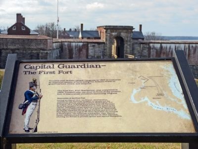
Capital Guardian
The First Fort
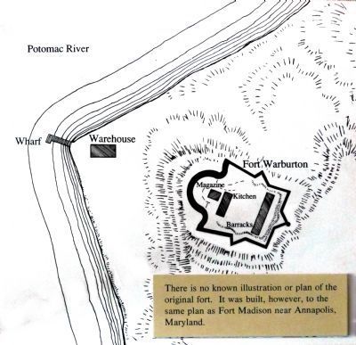
The first fort, Fort Warburton, was completed in 1809. Located near the river in front of the present fort, it was a small structure mounting 13 guns.
Destruction of the First Fort
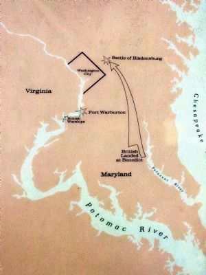
During the War of 1812, the British, determined to retaliate for the American invasion of Canada and the destruction of York, planned to attack Washington, D.C. in August 1814. A British force landed from the Patuxent River and bypassed Fort Warburton on their march to the Capital. Defeating a small American force at Bladensburg, they captured Washington, D.C. on August 24. Meanwhile, six British warships moved up the Potomac and arrived off Fort Warburton on August 27, three days after the burning of Washington. The American commander, Capt. Samuel Dyson, abandoned and destroyed the fort on their approach, allowing the British to proceed upriver and capture Alexandria.
Topics. This historical marker is listed in these topic lists: Forts and Castles • War of 1812. A significant historical year for this entry is 1807.
Location. 38° 42.738′ N, 77° 1.977′ W. Marker is in Fort Washington, Maryland, in Prince George's County. Marker can be reached from Fort Washington Road, on the right when traveling south. Located in Fort Washington Park, just outside the visitors center / museum. Touch for map. Marker is at or near this postal address: 13551 Fort Washington Road, Fort Washington MD 20744, United States of America. Touch for directions.
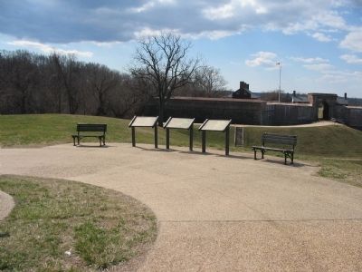
Other nearby markers. At least 8 other markers are within walking distance of this marker. A different marker also named Capital Guardian (here, next to this marker); a different marker also named Capital Guardian (here, next to this marker); Battery Decatur and Disappearing Guns (within shouting distance of this marker); Fort Washington Park (about 300 feet away, measured in a direct line); Main Gateway (about 400 feet away); The Northwest Demi-Bastion (about 400 feet away); The Water Battery (about 700 feet away); Caponiere (about 700 feet away). Touch for a list and map of all markers in Fort Washington.
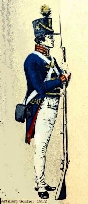
More about this marker. On the left side of the marker is a drawing of an Artillery Soldier, 1812. On the right, a map details the location of Fort Warburton respective to the British land and river movements described in the text.
Also see . . .
1. Fort Washington. National Park Service site. (The site is undergoing some modification and some content is off line at this time.) (Submitted on May 28, 2008, by Craig Swain of Leesburg, Virginia.)
2. Fort Warburton.
The First Fort, National Park Service (Submitted on December 10, 2013, by Allen C. Browne of Silver Spring, Maryland.)
Photographed By Craig Swain, March 1, 2008
4. Old Fort Warburton Location
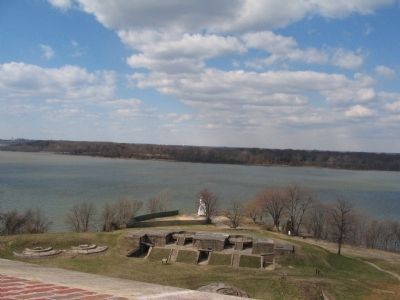
After its destruction, Fort Washington's water batteries were built over the remains of the old fort. Later Endicott System batteries were placed on top of the water batteries. Thus the ground in front of the fort was the site of three different fortification systems.
Credits. This page was last revised on June 16, 2016. It was originally submitted on May 28, 2008, by Craig Swain of Leesburg, Virginia. This page has been viewed 1,292 times since then and 31 times this year. Photos: 1. submitted on May 28, 2008, by Craig Swain of Leesburg, Virginia. 2. submitted on May 26, 2008, by Craig Swain of Leesburg, Virginia. 3. submitted on December 10, 2013, by Allen C. Browne of Silver Spring, Maryland. 4. submitted on May 28, 2008, by Craig Swain of Leesburg, Virginia. 5, 6, 7. submitted on December 10, 2013, by Allen C. Browne of Silver Spring, Maryland.
