Coffeeville in Clarke County, Alabama — The American South (East South Central)
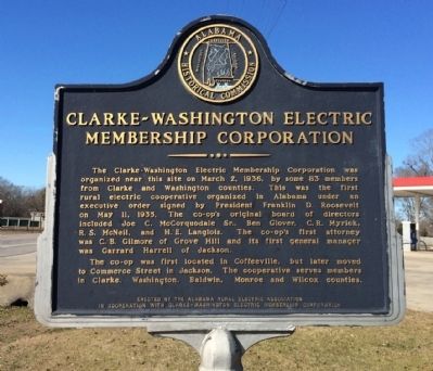
Clarke-Washington Electric Membership Corporation
Inscription.
The Clarke-Washington Electric Membership Corporation was organized near this site on March 2, 1936, by some 83 members from Clarke and Washington Counties. This was the first rural electric cooperative organized in Alabama under an executive order signed by President Franklin D. Roosevelt on May 11, 1935. The co-op's original board of directors included Joe C. McCorquodale, Sr., Ben Glover, C. R. Myrick, R. S. McNeill, and H. E. Langlois. The co-op's first attorney was C. B. Gilmore of Grove Hill and its first general manager was Garrard Harrell of Jackson.
The Co-op was first located in Coffeeville, but later moved to Commerce Street in Jackson. The cooperative serves members in Clarke, Washington, Baldwin, Monroe and Wilcox counties.
Erected by the Alabama Rural Electric Association in cooperation with Clarke-Washington Electric Membership Corporation.
Topics and series. This historical marker is listed in this topic list: Industry & Commerce. In addition, it is included in the Rural Electrification 💡 series list. A significant historical month for this entry is March 1991.
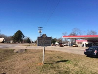
Location. 31° 45.352′ N, 88° 5.099′ W. Marker is in Coffeeville, Alabama, in Clarke County. Marker is at the intersection of U.S. 84 and River Street, on the right when traveling west on U.S. 84. Touch for map. Marker is at or near this postal address: US Highway 84, Coffeeville AL 36524, United States of America. Touch for directions.
Other nearby markers. At least 8 other markers are within 14 miles of this marker, measured as the crow flies. Ulcanush Baptist Church (approx. 2.1 miles away); The Mitchell Reserve (approx. 3.4 miles away); West Bend (approx. 5.4 miles away); Little Place Cemetery / Mt. Pleasant Baptist Church Womack Hill Community (approx. 9.9 miles away); Mitcham Beat and the Mitcham War (approx. 10.2 miles away); Fort Landrum Site (approx. 11.9 miles away); Creek Indian War (approx. 12.9 miles away); Springhill Missionary Baptist Church Cemetery (approx. 13.3 miles away). Touch for a list and map of all markers in Coffeeville.
Credits. This page was last revised on June 16, 2016. It was originally submitted on January 18, 2015, by Mark Hilton of Montgomery, Alabama. This page has been viewed 490 times since then and 46 times this year. Photos: 1, 2, 3. submitted on January 18, 2015, by Mark Hilton of Montgomery, Alabama.


