Victoria in Ellis County, Kansas — The American Midwest (Upper Plains)
Victoria
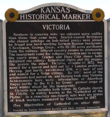
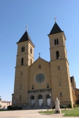
Victoria now includes both towns. Its Catholic church, St. Fidelis, is widely known as the “Cathedral of the Plains.” In a cemetery one-fourth mile west are graves of track workers massacred by Cheyennes in 1867.
Erected by Kansas Historical Society and State Highway Commission. (Marker Number 40.)
Topics and series. This historical marker is listed in this topic list: Settlements & Settlers. In addition, it is included in the Kansas Historical Society series list. A significant historical year for this entry is 1873.
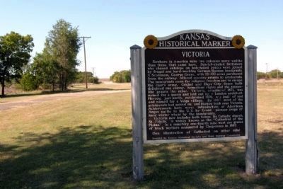
Location. This marker has been replaced by another marker nearby. 38° 50.795′ N, 99° 8.815′ W. Marker is in Victoria, Kansas, in Ellis County. Marker is at the intersection of Old Highway 40 and Ball Park Road, on the right when traveling east on Old Highway 40. Touch for map. Marker is in this post office area: Victoria KS 67671, United States of America. Touch for directions.
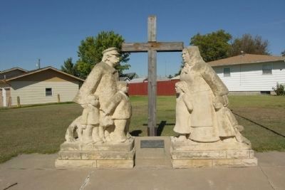
Other nearby markers. At least 8 other markers are within 10 miles of this location, measured as the crow flies. Union Pacific Employees Killed In Cheyenne Indian Raid (approx. 0.2 miles away); In Memory of the SETH Siblings (approx. 0.2 miles away); Capuchin - Franciscan Friars (approx. 0.7 miles away); Cathedral of the Plains (approx. ¾ mile away); Pioneer Family (approx. ¾ mile away); Veterans Memorial (approx. 1.3 miles away); Merci Train Boxcar (approx. 8.4 miles away); Avenue of Flags (approx. 9.6 miles away). Touch for a list and map of all markers in Victoria.
Also see . . . Victoria, Kansas - Legends of Kansas. (Submitted on January 21, 2015.)
Additional commentary.
1. Replacement Marker
The marker was replaced in 2011-2012 by a new Kansas state blue-and-white historical marker at the same location. The new marker reads:
Victoria was established in 1872 by George Grant, a wealthy Scotsman who chose the name for the reigning queen of England. Grant hoped to make a profit by recruiting others to raise cattle. After his death, many of the Englishmen he recruited left the area. German Russians arrived looking for good land and the freedom to follow their traditional way of life. Their descendants built St. Fidelis Church.
While passing through Victoria in 1912, presidential candidate and Nebraska congressman William Jennings Bryan was so struck by St. Fidelis Church that he bestowed a memorable title upon it: “Cathedral on the Plains.” The giant building spoke volumes about the devotion of the families in the parish. Each parishioner at least 12 years of age was obliged to contribute six wagonloads of stone, which had to be quarried and loaded by hand. With seating for 1,100, it ranked as one of the largest churches in Kansas when it opened in 1911.
St. Fidelis Church is listed in the National Register of Historic Places.
— Submitted January 21, 2015.
Credits. This page was last revised on June 16, 2016. It was originally submitted on January 21, 2015, by Duane Hall of Abilene, Texas. This page has been viewed 533 times since then and 16 times this year. Photos: 1, 2, 3, 4. submitted on January 21, 2015, by Duane Hall of Abilene, Texas.


