A Shared Neighborhood
City Within a City
— Greater U Street Heritage Trail —
Although Washington, D.C., has been a racially segregated city for much of its history, black and white Washingtonians have shared parts of this neighborhood.
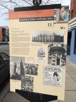
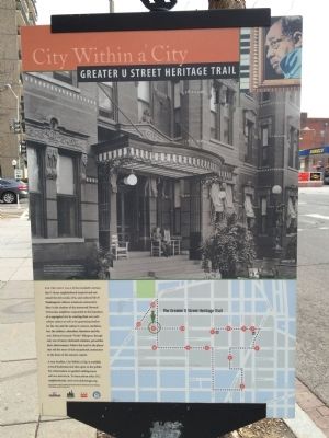
The modern building across 15th Street sits on the site of Portner Flats, demolished in 1974. An 1897 apartment building, the Portner was occupied by white residents until the end of World War II. Its grand public dining room and parlors, large, high-ceilinged apartments, and many resident services made it a sought after address. Its elaborate drugstore entrance was a landmark on the corner.
In 1945, the Portner Flats became the Dunbar Hotel, at one time the largest black hotel in the nation. It was named for poet Paul Laurence Dunbar, who once lived in the adjacent neighborhood of LeDroit Park. The hotel became a popular gathering place for famous sports and entertainment figures, Howard University faculty, and other black professionals. Just up 15th Street stands St. Augustine Catholic Church, the city’s oldest predominantly black Catholic congregation, founded in 1858 at 15th and L Streets. In 1961, the congregation took the dramatic step and merged with a white congregation, St. Paul’s Roman Catholic Church, and moved into its 1883 Gothic Revival building. You can see it just north of the old Dunbar Hotel site, at the corner of Fifteenth and V Street. For
20 years, until 1982, it was known as St. Paul and Augustine. Today it continues to actively welcome members of all races and ethnic groups.Erected by Cultural Tourism DC. (Marker Number 11.)
Topics and series. This historical marker is listed in these topic lists: African Americans • Churches & Religion. In addition, it is included in the Greater U Street Heritage Trail, and the Historically Black Colleges and Universities series lists. A significant historical year for this entry is 1974.
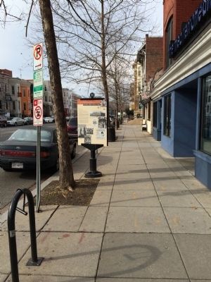
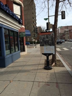
Location. 38° 55.025′ N, 77° 2.087′ W. Marker is in Northwest Washington in Washington, District of Columbia. It is in U Street Corridor. Marker is at the intersection of U Street Northwest and 15th Street Northwest, on the right when traveling west on U Street Northwest. Touch for map. Marker is at or near this postal address: 1501 U Street Northwest, Washington DC 20009, United States of America. Touch for directions.
Other nearby markers. At least 8 other markers are within walking distance of this marker. Paul Laurence Dunbar Apartments (within shouting distance of this marker); The Northumberland Apartments (about 400 feet away, measured in a direct line); St. Augustine Roman Catholic Church (about 500 feet away); A Prestige Address (about 500 feet away); Strong Families and Eminent Citizens (about 500 feet away); This is part of the Shaw neighborhood (about 600 feet away); Meridian Hill Park (about 600 feet away); Riots to Renaissance (about 700 feet away). Touch for a list and map of all markers in Northwest Washington.
More about this marker.
Photo captions (clockwise from top):
The Portner Flats, top, became the Dunbar Hotel after World War II, with an elaborate drugstore on the corner of 15th and U, right.
St. Augustine Catholic Church is a landmark at 15th and V Streets. Its 1920s church choir is pictured top right and a 1990s worship service, right.
[Caption on reverse side of marker:]
A resident relaxes on the porch of the elegant Portner Flats apartment buildings in 1897, shortly after its construction. It once stood directly across 15th Street. The Historical Society of Washington, D.C.
Credits. This page was last revised on January 30, 2023. It was originally submitted on January 25, 2015, by J. Makali Bruton of Accra, Ghana. This page has been viewed 472 times since then and 18 times this year. Last updated on March 7, 2019, by Devry Becker Jones of Washington, District of Columbia. Photos: 1, 2, 3, 4. submitted on January 25, 2015, by J. Makali Bruton of Accra, Ghana.


