Vieux-Québec-Cap-Blanc-colline Parlementaire in Communauté-Urbaine-de-Québec, — Central Canada (French-Canadian)
Martello Towers / Tours Martello
Martello Tower 2 / Tour Martello 2
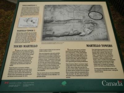
In the early 19th century, the British feared that the Americans, after gaining their independence (1776), would attempt to annex Upper and Lower Canada. In response to this threat, Gother Mann, as commanding officier of the Royal Engineers in Canada (1785-1804), urged the building of towers at Quebec to prevent an invader from approaching the existing fortifications.
Ralph Bruyères, Mann’s successor, began construction of four towers in the summer of 1808. James Craig, who was then the governor of the colony, ordered the work to go ahead without consent from the authorities in London, whom he presented with a “fait accompli”. By 1812, when war began, the towers were completed and ready for service.
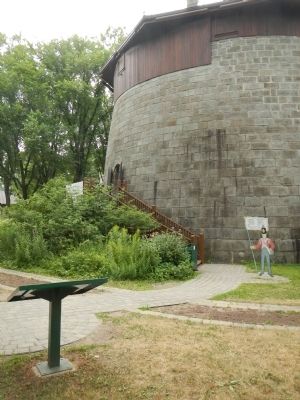
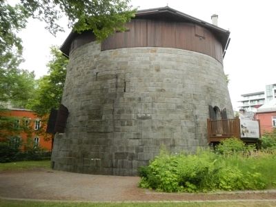
They stand almost parallel to the wall over the entire width of the promontory, ensuring each other’s defense. They were not identified with names but with numbers. Tower 1 overlooks the river on the Plains of Abraham; tower 2, is located at the intersection of Taché and Wilfrid-Lauier streets; tower 3, located at the intersection of René-Lévesque boulevard and Claire-Fontaine street, was torn down in 1905; finally, tower 4 is located on Lavigueur street in the Saint-Jean-Baptiste district.
To know more about Martello towers, visit the exhibition in Martello tower 1 during the summer period.
Martello tower 2 “towered over the surroundings when Ralph Bruyères proposed to build a redoubt around the tower. This redoubt was meant to have the shape of a bulwark and to face west. In the spring of 1809, the digging of the ditch was already underway but the redoubt was never built. Archaeological digs carried out in 1992-1993 have revealed the presence of a ditch, represented today by a semicircular path skirting the work.
French:
Au début du XIXᵉ siècle, les Britanniques craignent que les Américains, suite à l’obtention de leur indépendance (1776), ne tentent d’annexer le Haut et les Bas Canada à leur territoire. Devant cette menace, Gother Mann, commandant des ingénieurs royaux de Canada (1785-1804) préconise la construction d’ouvrages avancés de défense pour empêcher l’envahisseur de s’approcher déjà fortifications deja existantes.
Ralph Bruyéres, successeur de Mann, entreprend la construction de quatre tours Martello a l’ete de 1808. James Craig, alors gouverneur de la colonie, fait exécuter les travaux sans l’autorisation de Londres qu’il met devant la fait accompli. En 1812, lorsque la guerre éclate, les tours sont terminées et prêtes à servir.
Elles sont disposées à peu près parallèlement à l’enceinte sur toute la largeur du promontoire et se protègent mutuellement. Elles ne reçoivent pas de noms mais des numéros. La tour 1 surplombe le fleuve sur les plaines d’Abraham; la tour 2 est située au coin des rues Taché et Wilfrid-Laurier: la tour 3, située au coin du boulevard René-Lévesque et la rue Claire-Fontaine a été démolie en 1905 et la tour 4 est située sur la rue Lavigueur dans le quartier Saint-Jean-Baptiste.
Pour en savoir plus sur les tours Martello visitez l’exposition à la tour Martello 1 en période estivale.
La tour Martello 2 dominait les environs à l’époque où Ralph Bruyères proposa de construire une redoute entourant la tour. Cette redoute devait avoir la forme d’un bastion orienté vers l’ouest. One commença à creuser le fossé au printemps de 1809 mais la redoute ne fut jamais construite. Des fouilles archéologiques effectuées en 1992-1993 ont révélé la présence d’un fossé aujourd’hui représenté par un sentier en demi circle qui épouse la forme de l’ouvrage.
Erected by Parks Canada Parcs.
Topics. This historical marker is listed in this topic list: Forts and Castles. A significant historical year for this entry is 1808.
Location. 46° 48.224′ N, 71° 13.159′ W. Marker is in Québec, in Communauté-Urbaine-de-Québec. It is in Vieux-Québec-Cap-Blanc-colline Parlementaire. Marker is at the intersection of Avenue Wilfrid-Laurier and Avenue Taché, on the left when traveling east on Avenue Wilfrid-Laurier. Touch for map. Marker is at or near this postal address: 384 Avenue Wilfrid-Laurier, Québec G1R 2K9, Canada. Touch for directions.
Other nearby markers. At least 8 other markers are within walking distance of this marker. Martello Towers in Quebec / Tours Martello de Québec (about 90 meters away, measured in a direct line); Montcalm (about 120 meters away); O Canada! (about 150 meters away); Do You Know Joan of Arc? (about 150 meters away); A Golf Club on the Plains of Abraham (about 150 meters away); Frederick G. Todd (about 180 meters away); Québec Martello Towers (approx. 0.3 kilometers away); The / Le Royal Roussillon, (approx. 0.3 kilometers away). Touch for a list and map of all markers in Québec.
Credits. This page was last revised on February 9, 2023. It was originally submitted on February 17, 2015, by Barry Swackhamer of Brentwood, California. This page has been viewed 433 times since then and 25 times this year. Photos: 1, 2, 3. submitted on February 17, 2015, by Barry Swackhamer of Brentwood, California. • Andrew Ruppenstein was the editor who published this page.


