Near Corinne in Box Elder County, Utah — The American Mountains (Southwest)
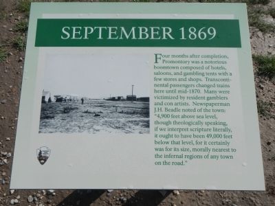
September 1869
Erected by National Park Service, U.S. Department of the Interior.
Topics. This historical marker is listed in this topic list: Railroads & Streetcars.
Location. 41° 37.071′ N, 112° 33.127′ W. Marker is near Corinne, Utah, in Box Elder County. Marker is on Golden Spike Road (22000 West Road) near 6400 North Road. Touch for map. Marker is in this post office area: Corinne UT 84307, United States of America. Touch for directions.
Other nearby markers. At least 8 other markers are within walking distance of this marker. September 8, 1942 (within shouting distance of this marker); The Locomotives of Golden Spike - Jupiter (within shouting distance of this marker); May 10, 1869 (within shouting distance of this marker); The Locomotives of Golden Spike - No. 119 (within shouting distance of this marker); May 9, 1869 (within shouting distance of this marker); a different marker also named September 1869 (within shouting distance of this marker); Last Spike Driven (about 300 feet away, measured in a direct line); Competition 1869 (about 300 feet away). Touch for a list and map of all markers in Corinne.
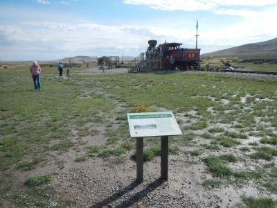
More about this marker. This marker is located in the exhibit area behind the Golden Spike Visitors Center.
Credits. This page was last revised on June 16, 2016. It was originally submitted on February 20, 2015, by Barry Swackhamer of Brentwood, California. This page has been viewed 431 times since then and 15 times this year. Photos: 1, 2. submitted on February 20, 2015, by Barry Swackhamer of Brentwood, California. • Andrew Ruppenstein was the editor who published this page.

