Sainte-Angèle-de-Monnoir in La Vallée-du-Richelieu, Québec — Central Canada (French-Canadian)
Fort Sainte-Thérèse
Le fort Sainte-Thérèse
— The Wooden Fort Era / Au temps des forts de bois —
Photographed By Barry Swackhamer, August 4, 2014
1. Fort Sainte-Thérèse Marker
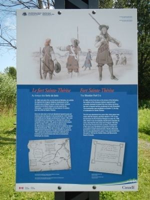
Captions (English / French): (top right) Soldiers from Carignan-Salières Regiment. / Des soldats du régiment Carignan-Salières.; (bottom left) Plan of the three wooden forts built by the Carigan-Salières Regiment on the Richelieu River. / Plan des trois forts construits par le Regiment Carigan-Salières sur le Richelieu.; (bottom right) Plan of the Fort Sainte-Thérèse, 1665. / Plan du fort Sainte-Thérèse.
In 1665, not far from here on the shores of the Richelieu, the soldiers of the Carignan-Salieres regiment built a wooden stockade to protect the new colony and bring the war to Iroquois territory, southwest of Lake Champlain. The construction was completed on October 15, the day of celebration for Saint-Thérèse.
The fort was abandoned two years later when peace was made with the Iroquois, and then rebuilt in 1747. It was burned down by American Rangers on June 16, 1760, after which it was immediately rebuilt by the Chervalier de Lévis, who fired the fort at the end of August 1760 after the fall of the French fort at Île aux Noix. In September of the same year, the British occupied the fort site and proceeded to install entrenchments. Shortly afterwards, the fort was abandoned for good. It was resurrected from the past in 1923 by the Historic Sites and Monuments Board of Canada.
French:
En 1665, tout près d’ici, sur les bords du Richelieu, les soldats du régiment de Carignan-Salières construisent un fort de pieux pour protéger la jeune colonie et pour conduire la guerre en territoire iroquois, au sud-ouest du lac Champlain. La construction est terminée le 15 octobre, jour de la fête de Sainte-Thérèse.
Deux ans plus tard, le fort est abandonné quand la paix est conclue avec les Iroquois. Il est reconstruit en 1747, Ensuite, il est brûlé par les Rangers américains le 16 juin 1760, mais immédiatement reconstruit par le chevalier de Lévis, qui l’incendie à la fin août 1760, après la chute du fort français de l’île aux Noix. En septembre de la même année, les Britanniques occupent le site du fort et mettent en place des retranchements. Mais peu de temps après, le fort est définitivement abandonné. Il surgira toutefois du passé en 1923, quand son importance historique nationale sera reconnue par la Commission des lieux et monuments historiques du Canada.
Erected by Parks Canada / Parcs Canada.
Topics. This historical marker is listed in this topic list: Forts and Castles. A significant historical month for this entry is June 1760.
Location. 45° 23.356′ N, 73° 15.53′ W. Marker is in Sainte-Angèle-de-Monnoir, Québec, in La Vallée-du-Richelieu. Marker is on Chemin Sainte-Thérèse (Québec Route 233) close to Rue de l'Île Sainte Marie, on the right when traveling east. Touch for map. Marker is in this post office area: Sainte-Angèle-de-Monnoir QC J0L 1P0, Canada. Touch for directions.
Other nearby markers. At least 8 other markers are within 10 kilometers of this marker, measured as the crow flies. Fort Ste. Therese (approx. 0.9 kilometers away); St. Stephen's Anglican Church (approx. 6.6 kilometers away); Chambly Canal (approx.
Photographed By Barry Swackhamer, August 4, 2014
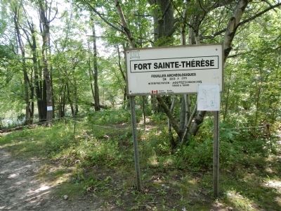
2. Fort Sainte-Thérèse Marker
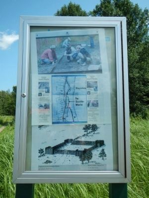
We forgot it… We knew it existed between Chambly and Saint-Jean-sur-Richelieu. The historian Réal Fortin unveiled the important role of Fort Sainte-Thérèse in our history.
«October 2nd, we planted the stake to build the fort Ste. Thérèse and started cutting down all the large and tall trees on the land (…) The 12th, I began to plant the palisade of the fort. the 15th all the palisades were planted around the fort.» (Free translation based on Henri Chastelard de Salière’s text, 1665)
Every Sunday in August from 10 a.m. to 4 p.m.
Guides from the Corporation historique du Fort Sainte-Thérèse will present the most recent archaeological discoveries.
Where?
In Cariganan, on the multipurpose path of the Chambly Canal National Historic Site. Meeting point: the fort Sainte-Thérèse interpretation panel, north of bridge no. 9.
Come visit us.
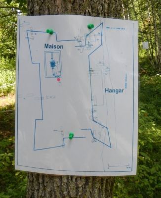
Sketch of Sainte-Thérèse fort. / Représentation du Fort Sainte-Thérèse.
«October 2nd, we planted the stake to build the fort Ste. Thérèse and started cutting down all the large and tall trees on the land (…) The 12th, I began to plant the palisade of the fort. the 15th all the palisades were planted around the fort.» (Free translation based on Henri Chastelard de Salière’s text, 1665)
Guides from the Corporation historique du Fort Sainte-Thérèse will present the most recent archaeological discoveries.
Where?
In Cariganan, on the multipurpose path of the Chambly Canal National Historic Site. Meeting point: the fort Sainte-Thérèse interpretation panel, north of bridge no. 9.
Come visit us.
Sketch of Sainte-Thérèse fort. / Représentation du Fort Sainte-Thérèse.
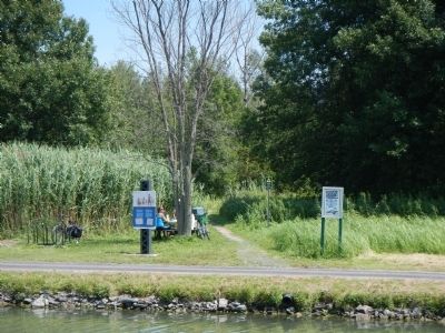
More about this marker. This marker is on Île Fryer on the multipurpose path heading north from the Rue de l'Île Sainte Marie bridge (Bridge/Pont No. 9). Île Fryer is part of the Canal Chambly National Historic Site.
Also see . . . Fort Sainte-Thérèse - Canal Chambly National Historic Site - Parks Canada. To permit the French army offensive against the Iroquois nations and to put an end to their attacks, a series of forts was built in 1665 and 1666 at the most strategic spots along the Richelieu River. This set the context for the building of Fort Sainte-Thérèse. <.i> (Submitted on March 28, 2015, by Barry Swackhamer of Brentwood, California.)
Credits. This page was last revised on June 16, 2016. It was originally submitted on March 28, 2015, by Barry Swackhamer of Brentwood, California. This page has been viewed 453 times since then and 23 times this year. Photos: 1, 2, 3, 4, 5, 6. submitted on March 28, 2015, by Barry Swackhamer of Brentwood, California. • Andrew Ruppenstein was the editor who published this page.
