Hoover in Jefferson County, Alabama — The American South (East South Central)
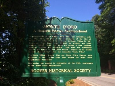
Monte D'Oro
A Historic Hoover Neighborhood
A neighborhood of 158 homes, Monte D'Oro was established July 23, 1964, which was prior to the incorporation of the City of Hoover. The neighborhood was build by developer William M. "Bill" Humphries. These homes were designed by architect and noted sculptor Cordray Parker. His works are located at area churches, hospitals, gardens and universities. Each home was individually planned and placed on tree lined streets. Inspired by his studies In Italy, the architect named the community "Monte D'Oro".
The Monte D'Fleurs Garden Club and Monte D'Oro planners were organized in 1971. These clubs later became the Monte D'Oro Neighborhood Association.
This marker was erected in recognition of the 50th Anniversary of the Monte D'Oro Neighborhood.
Erected 2014 by the Hoover Historical Society.
Topics. This historical marker is listed in this topic list: Notable Places. A significant historical date for this entry is July 23, 1955.
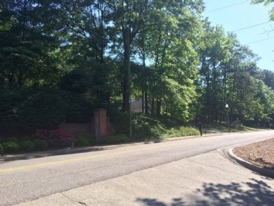
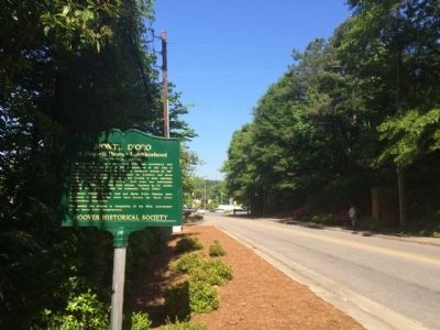
Location. 33° 24.414′ N, 86° 48.242′ W. Marker is in Hoover, Alabama, in Jefferson County. Marker is at the intersection of Wisteria Drive and Monte D'Oro Drive, on the left when traveling west on Wisteria Drive. Touch for map. Marker is at or near this postal address: 2809 Wisteria Drive, Birmingham AL 35216, United States of America. Touch for directions.
Other nearby markers. At least 10 other markers are within 3 miles of this marker, measured as the crow flies. Founding Of Hoover (approx. 0.3 miles away); Patton Chapel Church 1866 (approx. 1.1 miles away); Hoover (approx. 1.3 miles away); Rocky Ridge Elementary School (approx. 2.2 miles away); Shades Crest Road Historical District (approx. 2.4 miles away); Briarwood Presbyterian Church PCA (approx. 2.6 miles away); Hale - Joseph Home (approx. 2.8 miles away); Bluff Park Elementary School / Hoover Community Education (approx. 2.9 miles away); a different marker also named Shades Crest Road Historical District (approx. 3 miles away); Oxmoor Iron Furnaces (approx. 3 miles away). Touch for a list and map of all markers in Hoover.
Also see . . .
1. Monte D'Oro A Historic Hoover Neighborhood. Neighborhood Association website entry (Submitted on May 14, 2015, by Mark Hilton of Montgomery, Alabama.)
2. Historical marker dedication. AL.com website entry (Submitted on May 14, 2015, by Mark Hilton of Montgomery, Alabama.)
Credits. This page was last revised on October 21, 2022. It was originally submitted on May 14, 2015, by Mark Hilton of Montgomery, Alabama. This page has been viewed 686 times since then and 41 times this year. Photos: 1, 2, 3, 4. submitted on May 14, 2015, by Mark Hilton of Montgomery, Alabama.


