Prescott in Leeds and Grenville United Counties, Ontario — Central Canada (North America)
Fort Wellington
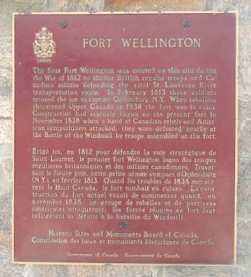
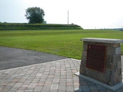
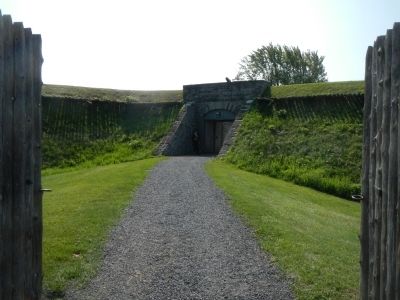
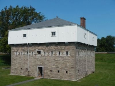
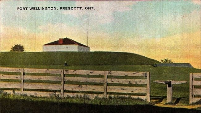
The first Fort Wellington was erected on this site during the War of 1812 to shelter British regular troops and Canadian militia defending the vital St. Lawrence River transportation route. In February 1813 those soldiers crossed the ice to capture Ogdensburg, N. Y. When rebellion threatened Upper Canada in 1838 the fort was in ruins. Construction had scarcely begun on the present fort in November 1838 when a band of Canadian rebels and American sympathizers attacked; they were defeated nearby at the Battle of the Windmill by troops assembled at this fort.
French:
Érigé ici, en 1812 pour défendre la voie stratégique de Sainte-Laurent, le premier fort Wellington logea des troupes régulières britanniques et des milices canadiennes. Traversant le fleuve gelé, cette petite armée s'empara d'Ogdensburg (N.Y.), en février 1813. Quand les troubles de 1838 menacèrent le Haut-Canada, le fort tombait en ruines. La construction du fort actuel de commencer quand, en novembre 1838, un groupe de rebelles et de partisans américains attaquèrent le forces réunies au fort leur infligèrent la défaite à la bataille du Windmill.
Erected by Historic Sites and Monument Board of Canada/Commission de lieux et monuments historique du Canada.
Topics. This historical marker is listed in these topic lists: Forts and Castles • War of 1812. A significant historical month for this entry is February 1813.
Location. 44° 42.783′ N, 75° 30.614′ W. Marker is in Prescott, Ontario, in Leeds and Grenville United Counties. Marker can be reached from Vankoughnet Street close to King Street East, on the left when traveling south. Touch for map. Marker is at or near this postal address: 276 Vankoughnet Street, Prescott ON K0E, Canada. Touch for directions.
Other nearby markers. At least 8 other markers are within walking distance of this marker. Prescott War Memorial (within shouting distance of this marker); Col. Edward Jessup (about 150 meters away, measured in a direct line); Prescott Barracks and Hospital (about 180 meters away); Fort Wellington Hospital (about 180 meters away); Bytown and Prescott Railway Company 1850 (about 210 meters away); Major James Morrow Walsh 1840-1905 (approx. 0.3 kilometers away); Lighthouse Restoration Project (approx. 0.3 kilometers away); Sir Richard William Scott (approx. 0.4 kilometers away). Touch for a list and map of all markers in Prescott.
More about this marker. This marker is located beside the Fort Wellington Visitors Centre.
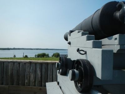
Also see . . . Fort Wellington - Wikipedia. Fort Wellington served as the rallying point for the local militia, and in early 1813 was also a base of operations for members of the Glengarry Light Infantry under the command of Lieutenant Colonel George Macdonell. On February 22, 1813, Macdonell led the approximately 500 men under his command in a drill exercise on the frozen St. Lawrence River. The British troops then streamed across the frozen river to attack the town of Ogdensburg, where they destroyed the military barracks and four American ships frozen in the ice, and returned to Prescott with significant amounts of food, ammunition, cannon and prisoners. (Submitted on May 18, 2015, by Barry Swackhamer of Brentwood, California.)
Photographed By Barry Swackhamer, August 8, 2014
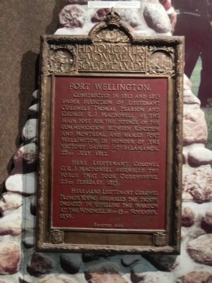
7. Fort Wellington plaque, located inside the blockhouse
Constructed in 1812 and 1813 under the direction of Lieutenant Colonels Thomas Pearson and George R.J. MacDonell as the main post for the defence of the communication between Kingston and Monteal, and named Fort Wellington, in honor of the victory gained at Salamanca, 22nd July, 1812.
Here Lieutenant Colonel G.R.J. MacDonell assembled the force that took Odgensbrug, 22nd February, 1813.
Here also Lieutenant Colonel Plomer Young assembled the troops engaged in repelling the invasion at the Windmill, 11th-13rh November, 1838.
Here Lieutenant Colonel G.R.J. MacDonell assembled the force that took Odgensbrug, 22nd February, 1813.
Here also Lieutenant Colonel Plomer Young assembled the troops engaged in repelling the invasion at the Windmill, 11th-13rh November, 1838.
Photographed By Barry Swackhamer, August 7, 2014
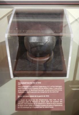
8. Cannonball from the War of 1812 / Boulet de canon datant de la guerre de 1812
This cannonball was fired from Ogdensburg, N.Y. at Fort Wellington near Prescott where it crashed into the officies’ mess. It was picked up by Colonel D.H. Burritt and fired back, so well-aimed that it the Odgensburg courthouse and was recognized as the same ball. / Ce boulet de canon fut tiré d’Ogdensburg, New York, du fort Wellington près Prescott et atterrit dans les quartiers des officiers. Il fut ramassé par le Colonel D.H Burritt et tiré à nouveau de façon si bien ciblée qu’il frappa le palais de justice d’Ogdensburg où il fut remarqué qu’il s’agissait bien du même boulet.
Photographed By Barry Swackhamer, August 8, 2014
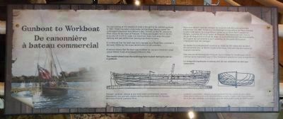
11. Gunboat to Workboat / De canonnière à bateau commercial (interpretive panel)
English:
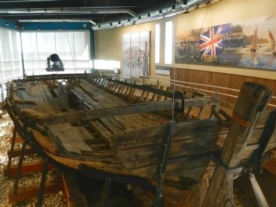
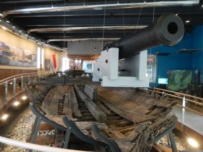
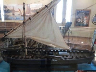
You are looking at the remains of what is thought to be a British gunboat*. In 1967, Parks Canada’s Underwater Archaeology Service raised this submerged shipwreck from Brown’s Bay, Ontario, on the St. Lawrence River about 40 km west of Prescott. It measures roughly 16.5 m (54 ft.) long and 4.9 (16 ft.) wide. Ice movement likely tore away the upper decking and part of the bow, leaving only these remains.
It is believed that the boat was built originally as a Royal Navy gunboat in the early 1800s but the exact identification is still uncertain.
Evidence shows that the boat was modified for use as a merchant cargo vessel before it was abandoned in Brown’s Bay.
The model show how the boat may have looked during the is use as a gunboat.
*The term “gunboat” referred to any small vessel carrying heavy cannons. Propelled by oars and sails, shallow draft gunboats were ideal for the bays and inlets of the St. Lawrence River.
(Text continues in French in next picture caption)
Photographed By Barry Swackhamer, August 8, 2014
12. Model of British Gunboat
French:
Vous avez devant vous les vestiges de ce qu’on croit être une canonnière* britannique. En 1967, le Service d’archéologie subaquatique de Parcs Canada a retiré cette épave de la baie Brown située sur le fleuve Saint-Laurent en Ontario, à environ 40 km à l’ouest de Prescott. Elle mesure environ 16.5m (54 pi) de long et 4.9 m (16 pi) de large. Ce sont probablement les mouvements de le glace qui ont arraché le pont supérieur de une partie de la proue, n’épargnant que ces vestiges.
Ce bateau fut probablement construit au début du XIXᵉ siècle afin de servir de canonnière pour la Marine royale britannique, mais son identité exacte est toujours incertaine.
Des preuves archéologiques indiquent que le bateau fut modifié pour servir comme navire marchand avant d’être finalement abandonne dans la baie Brown.
Le maquette représente le bateau lors de son utilisation de tant que canonnière.
*Le terme «canonnière» désigne un petite bâtiment muni de canons de gros calibre. Allant tant à voiles qu’à rames, les canonnières avaient un faible tirant d’eau et étaient de ce fait, bien adaptées pour naviguer dans les baies et les criques de Saint-Laurent.
Credits. This page was last revised on December 5, 2022. It was originally submitted on May 18, 2015, by Barry Swackhamer of Brentwood, California. This page has been viewed 485 times since then and 53 times this year. Last updated on November 4, 2022, by Carl Gordon Moore Jr. of North East, Maryland. Photos: 1, 2, 3, 4, 5, 6, 7. submitted on May 18, 2015, by Barry Swackhamer of Brentwood, California. 8, 9, 10, 11, 12. submitted on May 19, 2015, by Barry Swackhamer of Brentwood, California. 13. submitted on May 24, 2015. • Bill Pfingsten was the editor who published this page.
