Karaseki in Göreme in Nevşehir Merkez, Nevşehir, Turkey — West Asia or Southeast Europe
Karanlık (Dark) Church
Karanlık Kilise
Léglise Karanlık / Die Karanlık-Kirche
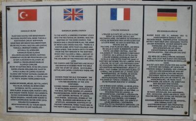
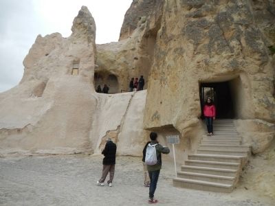
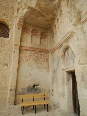
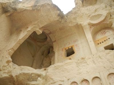
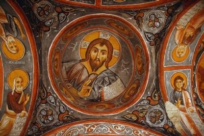
To the north, a winding stairway leads into the rectangular, barrel vaulted narthex of the Dark Church. This church has a cruciform plan, the arms of which are cross vaulted. There is a center dome, with four columns and three apses. This church gets its name from the tiny window in the narthex which only allows a small amount of light in. Due to the absence of light the colours of the frescoes are still vivid.
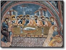
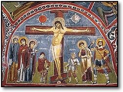
The church and the narthex are richly decorated in scenes from the bible and the story of Jesus. As in Elamlı (Apple) and Çarıkı Churches there are also scenes from the old testament. The church dates back to the end of the 12th and beginning of the 13th centuries.
Scenes: Deesis, annunciation, journey to Bethlehem, nativity, adoration of the Magi, baptism, raising of Lazarus, transfiguration, entry into Jerusalem, Last Supper, betrayal of Judas, crucifixion, anastasis, women at the tomb, blessing and mission of the Apostles, Ascension, hospitality of Prophet Abraham, three young me in the fiery furnace and portraits of the saints.
Turkish:
Kuzeydeki kavisli bir merdivenden kilisenin dikdörtgen, beşik tonozlu narteksine çıkılır. Narteksin güneyinde bir mezar bulunmaktadır. Kilise haç kolları çapraz tonozlu, merkezi kubbeli dört sütunlu, üç apsislidir karanlık kilise olarak adlandırılmasının nedeni, narteks kısmındaki küçük bir pencereden çok az ışık almasından dolayıdır. Bu sebeple fresklerdeki renkler oldukça canlıdır.
Kilise ve narteks incil ve İsa siklusunu içeren zengin süslemelere sahiptir ayrıca elmalı ve çarıklı kilisede oldugu gibi tevrat kaynaklı sahneler de resmedilmiştir. Kilise, 11. yüzyıl sonu 12. yüzyıl başına tarihlenmektedir.
Sahneler: Deesis, müjde, Beytüllahime yolculuk, doğum, üç müneccimin tapınması, vaftiz, Lazarusun diriltilmesi, başkalaşım, kudüse giriş, son akşam yemeği, İhanet, İsa çarmıhta, İsanin cehenneme inişi, göğe çıkışı, İbrahim peygamberin misafirperverliği, üç yahudi gencin yakılması ve aziz Tasvirleri.
French: To read the French text, click on the marker image to enlarge.
German: To read the German text, click on the marker image to enlarge.
Topics. This historical marker is listed in this topic list: Churches & Religion.
Location. 38° 38.347′ N, 34° 50.74′ E. Marker is in Göreme, Nevşehir, in Nevşehir Merkez. It is in Karaseki. Marker can be reached from Müze Cadde, on the right when traveling south. Touch for map. Marker is in this post office area: Göreme, Nevşehir 50180, Turkey. Touch for directions.
Other nearby markers. At least 8 other markers are within walking distance of this marker. Larder/Kitchen/Refectory (a few steps from this marker); Chapel of St. Catherine (a few steps from this marker); Çarıklı (Sandals) Church (a few steps from this marker); Yılanlı (St. Onuphorius) Church (within shouting distance of this marker); Elmalı (Apple) Church (within shouting distance of this marker); Chapel of St. Basil (within shouting distance of this marker); Chapel of St. Barbara (within shouting distance of this marker); Nunnery and Monastery (within shouting distance of this marker). Touch for a list and map of all markers in Göreme.
More about this marker. This marker is located at the Göreme Open Air Musem (Göreme Açik Hava Müzesi).
Also see . . . Churches of Göreme - Wikipedia. After the eruption of Mount Erciyes about 2,000 years ago, ash and lava formed soft rocks in the Cappadocia Region, covering a region of about 20,000 km2. The softer rock was eroded by wind and water, leaving the hard cap rock on top of pillars, forming the present-day fairy chimneys. People of Göreme, at the heart of the Cappadocia Region, realized that these soft rocks could be easily carved out to form houses, churches, monasteries. These Christian sanctuaries contain many examples of Byzantine art from the post-iconoclastic period. These frescoes are a unique artistic achievement from this period. (Submitted on June 4, 2015, by Barry Swackhamer of Brentwood, California.)
Credits. This page was last revised on February 13, 2023. It was originally submitted on June 4, 2015, by Barry Swackhamer of Brentwood, California. This page has been viewed 442 times since then and 8 times this year. Photos: 1, 2, 3, 4, 5, 6, 7. submitted on June 4, 2015, by Barry Swackhamer of Brentwood, California. • Andrew Ruppenstein was the editor who published this page.
