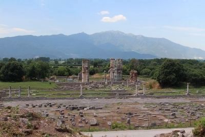
Near Filippi in Kavala, Macedonia and Thrace, Greece — Ελλάδα (Southeastern Europe, Balkan Peninsula)
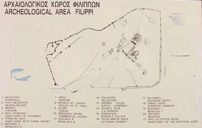
Archeological Area Filippi
Αρχαιολογικός Χώρος Φιλίππων
1. Acropolis
2. Neapolhs Gate
3. Theatre
4. Sanctuary of Sylvanus
5. Sanctuary with Three Niches
6. Basillica A
7. Heroon
8. Prison of Saint Paul
9. Forum
10. Commercial Agora
11. Basillika B
12. Palaestra
13. Baths - Assembly
14. V A Egnatia
15. Bishops Palace
16. Octagon Church
17. Balneum (Bath)
18. Funerary Heroon
19. Basilica C
20. Museum
21. Sanctuary of the Egyptian Gods
Topics. This historical marker is listed in these topic lists: Notable Places • Settlements & Settlers.
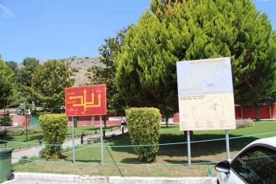
Location. 41° 0.737′ N, 24° 17.334′ E. Marker is near Filippi, Macedonia and Thrace, in Kavala. Marker can be reached from Agiou Christoforou west of Filippou, on the right when traveling west. This marker is located at the edge of the archaeological park's parking lot, very near the walkway that goes from the parking lot to the excavations and exhibits. Touch for map. Marker is at or near this postal address: Agiou Christoforou 21, Filippi, Macedonia and Thrace 640 03, Greece. Touch for directions.
Other nearby markers. At least 8 other markers are within 14 kilometers of this marker, measured as the crow flies. Philippi (about 120 meters away, measured in a direct line); Ancient Theater (about 150 meters away); Basilica (approx. 0.4 kilometers away); Annexes to Octagon at Philippi (approx. 0.4 kilometers away); Christian Philippi (approx. 0.4 kilometers away); The Octagon at Philippi (approx. 0.4 kilometers away); Black Sea - Silk Road (approx. 11.2 kilometers away); Neapolis-Christoupolis-Kavala (approx. 13.5 kilometers away). Touch for a list and map of all markers in Filippi.
Related markers. Click here for a list of markers that are related to this marker. To better understand the relationship, study each marker in the order shown.
Credits. This page was last revised on March 22, 2022. It was originally submitted on June 26, 2015, by Dale K. Benington of Toledo, Ohio. This page has been viewed 507 times since then and 15 times this year. Photos: 1. submitted on June 26, 2015, by Dale K. Benington of Toledo, Ohio. 2, 3, 4, 5. submitted on June 27, 2015, by Dale K. Benington of Toledo, Ohio. • Andrew Ruppenstein was the editor who published this page.
