Dearborn in Wayne County, Michigan — The American Midwest (Great Lakes)
The Neighborhood
that the Rouge Plant Built
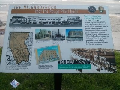
There has always been a lot to stop for here.
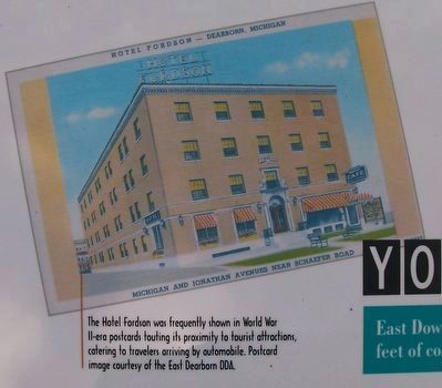
In the 1800s, the Six Mile Inn was a rural rest stop here along the Chicago Road (today's Michigan Avenue) from Detroit. But the development nearby in the early 1900s of Ford Motor Company's massive Rouge industrial complex changed everything. The Michigan / Schaefer neighborhood grew with the Ford workforce, becoming one of suburban Wayne County's main commercial centers, including department stores, a movie theater, City Hall and restaurants.
You Auto Know
East Downtown Dearborn grew to encompass a million square feet of commercial space, the size of a regional mall today.
Erected by Motorcities National Heritage Area, National Park Service.
Topics and series. This historical marker is listed in this topic list: Industry & Commerce. In addition, it is included in the MotorCities National Heritage Area series list.
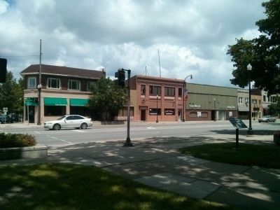
Location. 42° 19.282′ N, 83° 10.678′ W. Marker is in Dearborn, Michigan, in Wayne County. Marker is at the intersection of Michigan Avenue (U.S. 12) and Maple Street, on the right when traveling east on Michigan Avenue. Touch for map. Marker is at or near this postal address: 13615 Michigan Avenue, Dearborn MI 48126, United States of America. Touch for directions.
Other nearby markers. At least 8 other markers are within walking distance of this marker. Dearborn Town Hall Complex / Orville L. Hubbard (about 300 feet away, measured in a direct line); Dearborn War Memorial (about 300 feet away); Dearborn City Hall (about 300 feet away); The Schaefer Building (about 500 feet away); Dedicated to Christopher Columbus (approx. half a mile away); Fordson High School (approx. 0.6 miles away); The Ford Rotunda (approx. 0.6 miles away); Henry Ford Birthplace (approx. one mile away). Touch for a list and map of all markers in Dearborn.

Photographed By Joel Seewald, August 19, 2016
2. Top image
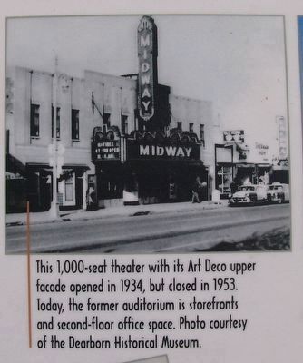
Look up and you can compare this 1946 image of Michigan Avenue between Maple and Neckel streets with what exists today. The third building from the left (in photo, the Dearborn Cocktail Bar) is perhaps the district's oldest, built in 1921. Photo courtesy of the Dearborn Historical Museum.
Photographed By Joel Seewald, August 19, 2016
3. Left image
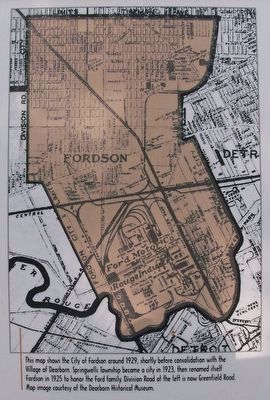
The map shows the city of Fordson around 1929, shortly before consolidation with the Village of Dearborn. Springwells Township became a city in 1923, then renamed itself Fordson in 1925 to honor the Ford family. Division Road at the left is now Greenfield Road. Map image courtesy of the Dearborn Historical Museum.
Photographed By Joel Seewald, August 19, 2016
4. Middle left image
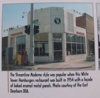
The Streamline Moderne style was popular when this White Tower Hamburgers restaurant was built in 1954 with a façade of baked enamel metal panels. Photo courtesy of the East Dearborn DDA. [The building pictured is at the southwest corner of Michigan Avenue and Calhoun Street.]
Photographed By Joel Seewald, August 19, 2016
6. Middle right image
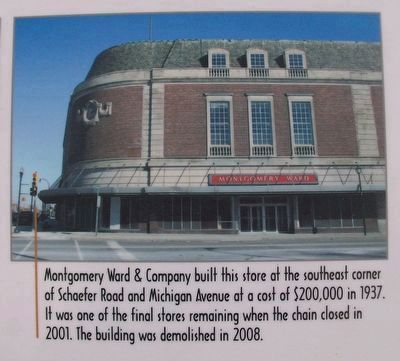
Montgomery Ward & Company built this store at the southeast corner of Schaefer Road and Michigan Avenue at a cost of $200,000 in 1937. It was one of the final stores remaining when the chain closed in 2001. The building was demolished in 2008.
Credits. This page was last revised on October 27, 2016. It was originally submitted on July 15, 2015, by Joel Seewald of Madison Heights, Michigan. This page has been viewed 660 times since then and 54 times this year. Photos: 1. submitted on July 15, 2015, by Joel Seewald of Madison Heights, Michigan. 2, 3, 4, 5, 6, 7. submitted on October 27, 2016, by Joel Seewald of Madison Heights, Michigan. 8. submitted on July 15, 2015, by Joel Seewald of Madison Heights, Michigan. • Bill Pfingsten was the editor who published this page.
