Near Crane in Crane County, Texas — The American South (West South Central)
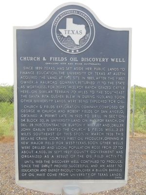
Church and Fields Oil Discovery Well
(Drilling site 2.25 miles southeast)
Church & Fields Exploration Company, composed of George M. Church and Robert Fields of San Angelo, obtained a permit late in 1925 to drill in section 34, block 30, in University land on McElroy Ranch. On Dec. 28, 1925, contractor Burton F. Weekley and Driller John Garlin started the Church & Fields well, 2.25 miles southeast of this spot. In March 1926 this became Crane County's first oil producer, opening a new major field for west Texas. Soon other wells were drilled and local population rose from 27 to about 4,500. In Sept. 1927 county government was organized as a result of the oil field activity.
Until 1955 the discovery well continued to produce. Since the day it proved successful and an asset to education and energy production, over a billion barrels of oil have come from University of Texas lands.
Erected 1978 by Texas Historical Commission. (Marker Number 851.)
Topics. This historical marker is listed in these topic lists: Education • Industry & Commerce. A significant historical month for this entry is March 1926.
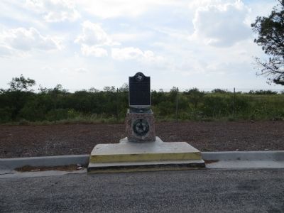
Location. 31° 30.199′ N, 102° 21.457′ W. Marker is near Crane, Texas, in Crane County. Marker is on U.S. 385, 7.4 miles north of Texas Highway 329, on the left when traveling north. Touch for map. Marker is in this post office area: Crane TX 79731, United States of America. Touch for directions.
Other nearby markers. At least 4 other markers are within 8 miles of this marker, measured as the crow flies. Crane County (here, next to this marker); William Carey Crane (approx. 7.4 miles away); Juan Cordona Lake (approx. 7.4 miles away); Crane High School (approx. 7.6 miles away).
Credits. This page was last revised on June 16, 2016. It was originally submitted on July 16, 2015, by Bill Kirchner of Tucson, Arizona. This page has been viewed 664 times since then and 28 times this year. Photos: 1, 2. submitted on July 16, 2015, by Bill Kirchner of Tucson, Arizona. • Andrew Ruppenstein was the editor who published this page.

