Near Sweet Briar in Amherst County, Virginia — The American South (Mid-Atlantic)
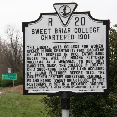
Sweet Briar College
Chartered 1901
This liberal arts college for women, opened in 1906, granted its first Bachelor of Arts degrees in 1910. Established under the will of Indiana Fletcher Williams as a memorial to her only daughter, Daisy, the college is located on a 2800-acre tract of land acquired by Elijah Fletcher before 1830. The eighteenth century homestead, remodeled and named "Sweet Briar House" by the Fletchers, is set in a boxwood garden.
Amherst County: 2 miles south of Amherst - U.S. Rt 29
Erected 1951 by Virginia State Library. (Marker Number R-20.)
Topics and series. This historical marker is listed in this topic list: Education. In addition, it is included in the Virginia Department of Historic Resources (DHR) series list. A significant historical year for this entry is 1906.
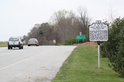
Location. 37° 33.162′ N, 79° 4.248′ W. Marker is near Sweet Briar, Virginia, in Amherst County. Marker is at the intersection of South Amherst Highway (Business U.S. 29) and Sweet Briar Road, on the right when traveling south on South Amherst Highway. It is at the entrance to the college, on the southbound lanes of the highway. Touch for map. Marker is at or near this postal address: 357 S Amherst Hwy, Amherst VA 24521, United States of America. Touch for directions.
Other nearby markers. At least 8 other markers are within 3 miles of this marker, measured as the crow flies. The Boxwood Alumnae House (approx. 0.7 miles away); Sweet Briar Plantation Slave Cabin (approx. 0.7 miles away); Sweet Briar House (approx. ¾ mile away); Rucker’s Chapel (approx. 2.3 miles away); James River Batteau (approx. 2.3 miles away); The Amherst Depot (approx. 2.3 miles away); Veterans Memorial Trees (approx. 2.4 miles away); Central High School (approx. 2.4 miles away). Touch for a list and map of all markers in Sweet Briar.
Also see . . .
1. Sweet Briar College - Wikipedia Entry. “The campus is situated on 3,250 acres in the foothills of the Blue Ridge Mountains. The college’s architecture is dominated by the work of Ralph Adams Cram, who also lent his architectural expertise to the campuses of Princeton University and West Point, among others.” (Submitted on August 21, 2011.)
2. A Sweet Briar Woman. Video produced by the College. (Submitted on August 21, 2011.)
Credits. This page was last revised on August 15, 2021. It was originally submitted on August 21, 2011, by J. J. Prats of Powell, Ohio. This page has been viewed 685 times since then and 17 times this year. Last updated on July 25, 2015, by J. Makali Bruton of Accra, Ghana. Photos: 1, 2. submitted on August 21, 2011, by J. J. Prats of Powell, Ohio. • Bill Pfingsten was the editor who published this page.

