Franconia in Fairfax County, Virginia — The American South (Mid-Atlantic)
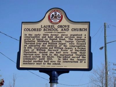
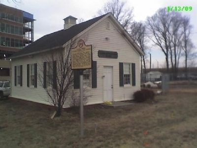
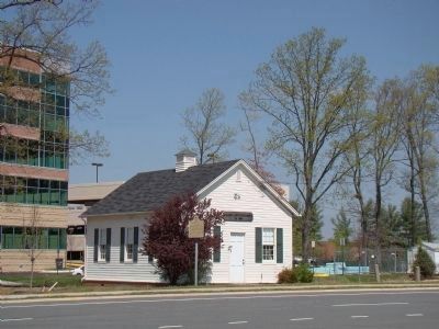
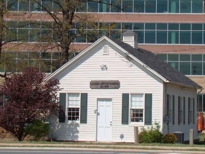
Laurel Grove Colored School and Church
Erected 2008 by Fairfax County History Commission.
Topics and series. This historical marker is listed in these topic lists: African Americans • Churches & Religion • Education. In addition, it is included in the Virginia, Fairfax County History Commission series list. A significant historical year for this entry is 1881.
Location. 38° 46.098′ N, 77° 9.303′ W. Marker is in Franconia, Virginia, in Fairfax County. Marker is on Beulah Street, 0.1 miles south of Walker Lane, on the right when traveling south. Touch for map. Marker is at or near this postal address: 6840 Beulah St, Alexandria VA 22310, United States of America. Touch for directions.
Other nearby markers. At least 8 other markers are within 3 miles of this marker, measured as the crow flies. Carrolltown (approx. 0.8 miles away); Franconia (approx. one mile away); Potter’s Hill (approx. 1.8 miles away); The Spy with the Glass Eye (approx. 1.8 miles away); The Rose Hill Raid (approx. 2.2 miles away); Rose Hill (approx. 2.2 miles away); a different marker also named Rose Hill (approx. 2.2 miles away); Springfield Station (approx. 2˝ miles away).
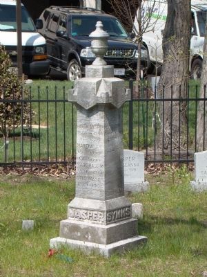
Regarding Laurel Grove Colored School and Church. The Church mentioned burned down completely. The church sign and cemetery are still standing
Also see . . .
1. About Laurel Grove School: Getting This History Out. (Submitted on January 15, 2009, by Kevin W. of Stafford, Virginia.)
2. History of Laurel Grove School. “The enthusiasm and pride of the colored teachers, parents, and the African American community prevailed against the resistance and harassment of the county’s white residents. Laurel Grove students remember closing the shutters of their school to prevent rocks from breaking windows. Yet, in this segregated school, without the facilities and supplies, Laurel Grove students learned geography without maps and competed successfully with their peers in colored fairs. A few followed the example of teachers, earning certificates to educate new generations of children in the county’s segregated public schools. ” (Submitted on April 21, 2009, by J. J. Prats of Powell, Ohio.)
Credits. This page was last revised on January 27, 2022. It was originally submitted on January 15, 2009, by Paul D Blumstein of Alexandria, Virginia. This page has been viewed 2,305 times since then and 70 times this year. Last updated on July 26, 2015, by J. Makali Bruton of Accra, Ghana. Photos: 1. submitted on April 21, 2009, by J. J. Prats of Powell, Ohio. 2. submitted on January 15, 2009, by Paul D Blumstein of Alexandria, Virginia. 3, 4, 5. submitted on April 21, 2009, by J. J. Prats of Powell, Ohio. • Bill Pfingsten was the editor who published this page.
