Quality Hill in Kansas City in Jackson County, Missouri — The American Midwest (Upper Plains)
Chez Les Canses or "Chouteau's"
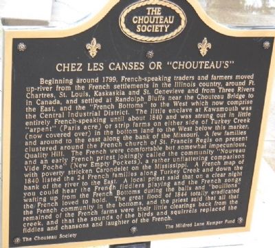
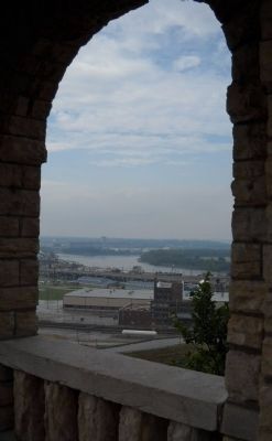
Beginning around 1799, French-speaking traders and farmers moved up-river from the French settlements in the Illinois country, around Ft. Chartres, St. Louis, Kaskaskia and St. Genevieve and from Three Rivers in Canada, and settled at Randolph Bluffs near the Chouteau Bridge to the east, and the "French Bottoms" to the West which now comprise the Central Industrial District. The little enclave at Kawsmouth was entirely French-speaking until 1840 and was strung out in little "arpent" (Paris acre) or strip farms on either side of Turkey Creek (now covered over) in the bottom land to the West below this marker, and around to the east along the bank of the Missouri. A few families clustered around the French church of St. Francis Regis on present Quality Hill. The French were comfortable but somewhat impecunious, and an early priest jokingly called the community "Nouveau Vide Poche" (New Empty Pockets), a rather unflattering comparison with poverty stricken Carondelet on the Mississippi. A French map of 1840 listed 24 French families along Turkey Creek and down the bank of the river to the East. A local priest said that on a clear night you could hear the French fiddlers playing and the French songs wafting up from the French Bottoms during the balls and "bouillons" the French loved to hold. The great flood of 1844 totally eradicated the French community in the bottoms, and the priest said that all that remained of the French farms were their little clearings back from the creek, and that the sounds of the birds and squirrels replaced the fiddles and chansons and laughter of the French.
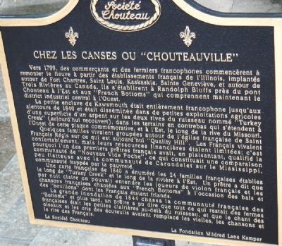
reverse of marker is the French translation
Erected by Chouteau Society and Mildred Lane Kemper Fund.
Topics. This historical marker is listed in this topic list: Settlements & Settlers. A significant historical year for this entry is 1799.
Location. 39° 6.163′ N, 94° 35.554′ W. Marker is in Kansas City, Missouri, in Jackson County. It is in Quality Hill. Marker is on Jefferson Street, 0 miles north of 10th Street, on the right when traveling south. Touch for map. Marker is in this post office area: Kansas City MO 64105, United States of America. Touch for directions.
Other nearby markers. At least 8 other markers are within walking distance of this marker. Lynching in America / Lynching of Levi Harrington (within shouting distance of this marker); James Pendergast (about 600 feet away, measured in a direct line); The Old French Cemetery (about 600 feet away); Etienne Veniard - Sieur de Bourgemont (approx. 0.2 miles away); Lewis and Clark (approx. 0.2 miles away); The French and the Lewis & Clark Expedition (approx. 0.2 miles away); Lewis and Clark Expedition Across Missouri
(approx. 0.2 miles away); Chouteau’s Church (St. Francis Regis) (approx. 0.2 miles away). Touch for a list and map of all markers in Kansas City.
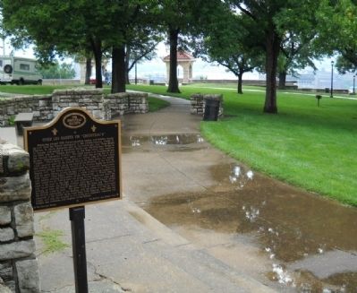
More about this marker. Parking during business hours Monday-Friday could be at a premium. This marker is tucked behind a retaining wall at the south end of Case Park.
Also see . . .
1. Chouteau Society. Jackson County Historical Society website entry (Submitted on September 11, 2009, by Thomas Onions of Olathe, Kansas.)
2. Kansas City, Missouri Visitor's Bureau. Official Link to the KCMO Vistor's Bureau (Submitted on September 11, 2009, by Thomas Onions of Olathe, Kansas.)
Credits. This page was last revised on February 10, 2023. It was originally submitted on September 11, 2009, by Thomas Onions of Olathe, Kansas. This page has been viewed 1,644 times since then and 35 times this year. Last updated on July 26, 2015, by Michael W. Kruse of Kansas City, Missouri. Photos: 1, 2, 3, 4. submitted on September 11, 2009, by Thomas Onions of Olathe, Kansas. • Bill Pfingsten was the editor who published this page.


