Johnstown in Leeds and Grenville United Counties, Ontario — Central Canada (North America)
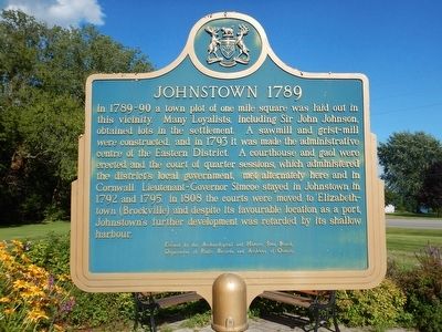
Johnstown 1789
Erected by Archaeological and Historic Sites Board, Department of Public Records and Archives of Ontario.
Topics. This historical marker is listed in these topic lists: Government & Politics • Settlements & Settlers. A significant historical year for this entry is 1793.
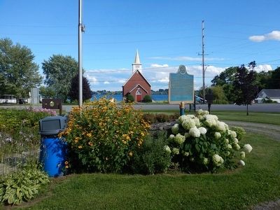
Location. 44° 44.692′ N, 75° 27.947′ W. Marker is in Johnstown, Ontario, in Leeds and Grenville United Counties. Marker is at the intersection of Provincial Highway 2 and Provincial Highway 16, on the right when traveling west on Provincial Highway 2. Marker is located in a lovely turnout in the shadows of the Ogdensburg/Prescott bridge that crosses the St. Lawrence river. Touch for map. Marker is in this post office area: Johnstown ON K0E 1T1, Canada. Touch for directions.
Other nearby markers. At least 8 other markers are within 5 kilometers of this marker, measured as the crow flies. Eastern Ontario's First Court House and Gaol (here, next to this marker); Fort de Levis (approx. 1.4 kilometers away); The Battle of the Windmill (approx. 3.1 kilometers away); Welcome to the Site of The Battle of the Windmill (approx. 3.1 kilometers away); a different marker also named The Battle of the Windmill (approx. 3.1 kilometers away); Nicholas "Nic" Sovie USMC (approx. 4.2 kilometers away in the U.S.); Global War on Terrorism Memorial (approx. 4.2 kilometers away in the U.S.); Korean War Veterans (approx. 4.2 kilometers away in the U.S.). Touch for a list and map of all markers in Johnstown.
Credits. This page was last revised on September 27, 2019. It was originally submitted on August 8, 2015, by Kevin Craft of Bedford, Quebec. This page has been viewed 338 times since then and 24 times this year. Photos: 1, 2. submitted on August 8, 2015, by Kevin Craft of Bedford, Quebec.

