Near Stonewall in Gillespie County, Texas — The American South (West South Central)
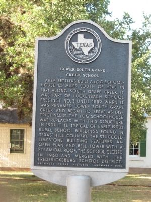
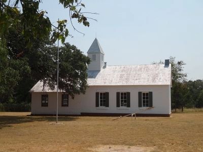
Lower South Grape Creek School
Erected 1994. (Marker Number 10073.)
Topics. This historical marker is listed in these topic lists: Education • Notable Buildings • Settlements & Settlers. A significant historical year for this entry is 1871.
Location. 30° 13.402′ N, 98° 43.684′ W. Marker is near Stonewall, Texas, in Gillespie County. Marker is on U.S. 290, on the right when traveling east. 10 miles west of Stonewall on U.S. Hwy 290. Touch for map. Marker is in this post office area: Stonewall TX 78671, United States of America. Touch for directions.
Other nearby markers. At least 8 other markers are within 5 miles of this marker, measured as the crow flies. General E. Kirby Smith, C.S.A. (approx. 0.4 miles away); Luckenbach School (approx. 3.1 miles away); Engel Family (approx. 3.4 miles away); Luckenbach (approx. 3˝ miles away); President's Ranch Trail (approx. 4 miles away); Lyndon Baines Johnson (approx. 4 miles away); Major Israel M. Nunez (approx. 4 miles away); Stonewall Community Cemetery (approx. 4.1 miles away). Touch for a list and map of all markers in Stonewall.
Credits. This page was last revised on June 16, 2016. It was originally submitted on March 21, 2010, by Steve Gustafson of Lufkin, Texas. This page has been viewed 1,330 times since then and 73 times this year. Last updated on September 3, 2015, by Renee' Lasswell of Austin, Texas. Photos: 1. submitted on March 21, 2010, by Steve Gustafson of Lufkin, Texas. 2. submitted on September 3, 2015, by Renee' Lasswell of Austin, Texas. • Bill Pfingsten was the editor who published this page.

