Chambly in La Vallée-du-Richelieu, Québec — Central Canada (French-Canadian)
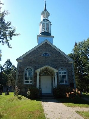
St. Stephen's Anglican Church
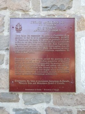
L'Église Anglicane de St. Stephens
English:
Erected in 1820, this church served the garrison of the nearby fort as well as the civilian population of Chambly. Seating was extended to accommodate the garrison by altering the pew arrangement in 1833 and adding side galleries in 1839. The stone font was donated by the troops. Although in continuous use and despite minor modifications, the church remains an outstanding example of early 19th-century Canadian ecclesiastical architecture.
French:
Cette église fut construite en 1820, à l'intention de la garnison de fort et de la population de Chambly. En 1833, on réaménagea des bancs, et en 1839, on prolongea la gallerie arrière sur les deux côtés de l'édifice, de façon à accomoder les militaires qui firent don a l'église des fonds baptismaux. Meme si cette dernière a servi sans interruption et a subi de légères modifications depuis 1820, elle demeure un exemple marquant de l'architecture religieuse canadienne du début du XIXe siècle.
Erected 1970 by Historic Sites and Monuments Board of Canada.
Topics and series. This historical marker is listed in this topic list: Churches & Religion. In addition, it is included in the Canada, Historic Sites and Monuments Board series list. A significant historical year for this entry is 1820.
Location. 45° 26.878′ N, 73° 16.429′ W. Marker is in Chambly, Québec, in La Vallée-du-Richelieu. Marker is at the intersection of Bourgogne Avenue and Henderson Street, on the left when traveling west on Bourgogne Avenue. Marker is attached to the facade of the church to the right of the entrance. Touch for map. Marker is at or near this postal address: 1988 Bourgogne Avenue, Chambly QC J3L 1Z4, Canada. Touch for directions.
Other nearby markers. At least 8 other markers are within 13 kilometers of this marker, measured as the crow flies. Fort Chambly (approx. 0.3 kilometers away); General John Thomas (approx. 0.4 kilometers away); Fort Chambly Cemetery (approx. 0.4 kilometers away); Chambly Canal (approx. 0.8 kilometers away); Albani (approx. 1.7 kilometers away); Fort Ste. Therese (approx. 5.8 kilometers away); Fort Sainte-Thérèse (approx. 6.6 kilometers away); Second Battle of La Prairie (approx. 12.1 kilometers away). Touch for a list and map of all markers in Chambly.
Also see . . . Parks Canada - St. Stephen's Anglican Church. (Submitted on September 16, 2015, by Kevin Craft of Bedford, Quebec.)
Credits. This page was last revised on June 16, 2016. It was originally submitted on September 16, 2015, by Kevin Craft of Bedford, Quebec. This page has been viewed 313 times since then and 19 times this year. Photos: 1, 2. submitted on September 16, 2015, by Kevin Craft of Bedford, Quebec.

