Port Allen in West Baton Rouge Parish, Louisiana — The American South (West South Central)
Louisiana Purchase - West Baton Rouge Early History
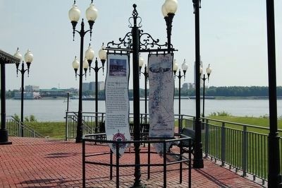
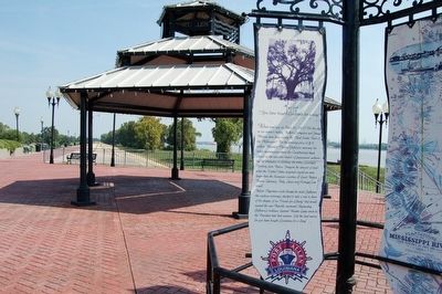
(panel 1)
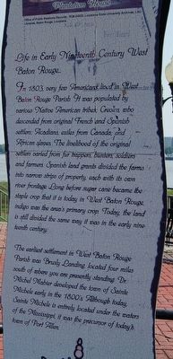
Life in Early Nineteenth Century West Baton Rouge…
In 1803, very few Americans lived in West Baton Rouge Parish. It was populated by various Native American tribes; Creoles, who descended from original French and Spanish settlers; Acadians, exiles from Canada; and African slaves. The livelihood of the original settlers varied from fur trappers, hunters, soldiers and farmers. Spanish land grants divided the farms into narrow strips of property, each with its own river frontage. Long before sugar cane became the staple crop that it is in West Baton Rouge, indigo was the area's primary crop. Today, the land is still divided the same way it was in early nineteenth century.
The earliest settlement in West Baton Rouge Parish was Brusly Landing, located 4 miles south of where you are presently standing. Dr. Michele Mahier developed the town of Sainte Michele early in the 1800's. Although today, Sainte Michele is entirely located under the waters of the Mississippi, it was the precursor of today's Town of Port Allen
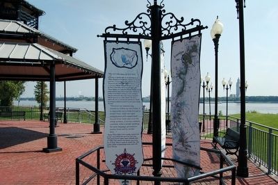
(panel 2)
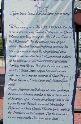
"…You have bought Louisiana for a song."
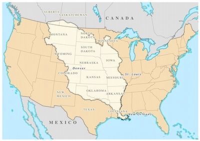
Where were you on April 30, 1803? On this day in our nation's history, Robert Livingston and James Monroe were busy closing the "Real Estate Deal of the Millennium!" For the amazing price of $15 million, President Thomas Jefferson overcame his initial apprehension about the Constitutional limits placed on the executive branch of government, authorizing his emissaries to purchase the entire Louisiana Territory from France. Imagine the amount of land - what the United States acquired covered an area larger than the European countries of Great Britain, France, Germany, Italy, Spain and Portugal combined!
Before Napoleon could change his mind, Jefferson, the cautious visionary, decided to take a risk in favor of his dreams of an "Empire of Liberty' that would expand the new Republic westward. Applauding Jefferson's boldness, General Horatio Gates wrote to the President later that summer, "Let the land rejoice, for you have bought Louisiana for a song."
(panel 3)
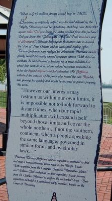
What a $15 million dream could buy in 1803…
Louisiana, as originally settled, was the land drained by the Mighty Mississippi and her tributaries, stretching over 800.000 square miles! Did you know 17 states resulted from this purchase? Did you know Yellowstone National Park was once part of Louisiana? Although his original motivation was to acquire the Port of New Orleans and it's associated trading rights, Thomas Jefferson soon realized his Louisiana Purchase would greatly benefit this newly formed sovereign nation. With this one purchase, he had obtained a territory for a price calculated at about four cents an acre, whose natural resources amounted to riches far beyond anyone's wildest dreams! Mr. Jefferson withstood the criticism of his peers who feared the new Republic was growing too quickly and would be too vast to govern properly. He wrote:
However our interests may restrain us within our own limits, it is impossible not too look forward to distant times, when our rapid multiplication will expand itself beyond those limits and cover the whole northern, if not southern, continent, when a people speaking the same language, governed in similar forms and similar laws..."
President Thomas Jefferson sent an expedition westward to find and map a transcontinental water route to the Pacific Ocean. With approval from Congress, Captain Meriwether Lewis and William Clark embarked on their legendary 3-year journey from St. Charles, Missouri to explore the uncharted West. Their expedition included 33 party members, known as the Corps of Discovery.
Topics and series. This historical marker is listed in these topic lists: Patriots & Patriotism • Settlements & Settlers. In addition, it is included in the Former U.S. Presidents: #03 Thomas Jefferson, and the Former U.S. Presidents: #05 James Monroe series lists. A significant historical date for this entry is April 30, 1803.
Location. 30° 27.153′ N, 91° 12.127′ W. Marker is in Port Allen, Louisiana, in West Baton Rouge Parish. Marker can be reached from the intersection of Court Street (County Route 987-4) and Route 987-5. Marker is on top of Mississippi River levee, in the Old Ferry Landing plaza. Touch for map. Marker is in this post office area: Port Allen LA 70767, United States of America. Touch for directions.
Other nearby markers. At least 8 other markers are within walking distance of this marker. Bridging Communities (a few steps from this marker); Mississippi River Old Ferry Landing (a few steps from this marker); Mississippi River (within shouting distance of this marker); Oaks Plantation (approx. 0.3 miles away); Gear from Cinclare Mill (approx. 0.6 miles away); Third Parish Courthouse (approx. 0.6 miles away); Port Allen Prisoner-Of-War Sub-Camp No. 7 (approx. 0.6 miles away); West Baton Rouge Parish Bicentennial (approx. 0.7 miles away). Touch for a list and map of all markers in Port Allen.
Also see . . . Wikipedia Entry. “The Kingdom of France controlled the Louisiana territory from 1699 until it was ceded to Spain in 1762. Napoleon in 1800, hoping to re-establish an empire in North America, regained ownership of Louisiana. The dream of a new empire failed and Napoleon decided to sell Louisiana to the United States. The Americans originally sought to purchase only the port city of New Orleans and its adjacent coastal lands, but quickly accepted the bargain. The Louisiana Purchase occurred during the term of the third President of the United States, Thomas Jefferson, (1743-1826). Before the purchase was finalized, the decision faced Federalist Party opposition; they argued that it was unconstitutional to acquire any territory. Jefferson agreed that the U.S. Constitution did not contain explicit provisions for acquiring territory, but he did have full treaty power and that was enough.” (Submitted on December 19, 2015.)
Credits. This page was last revised on April 29, 2017. It was originally submitted on September 26, 2015. This page has been viewed 759 times since then and 32 times this year. It was the Marker of the Week December 20, 2015. Photos: 1. submitted on September 26, 2015. 2. submitted on December 19, 2015, by J. J. Prats of Powell, Ohio. 3, 4, 5, 6, 7. submitted on September 26, 2015. • Bernard Fisher was the editor who published this page.
