Wise in Wise County, Virginia — The American South (Mid-Atlantic)
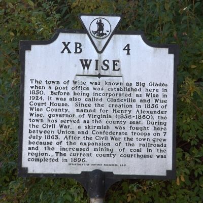
Wise
Erected 2001 by Department of Historic Resources. (Marker Number XB-4.)
Topics and series. This historical marker is listed in this topic list: Political Subdivisions. In addition, it is included in the Virginia Department of Historic Resources (DHR) series list. A significant historical year for this entry is 1850.
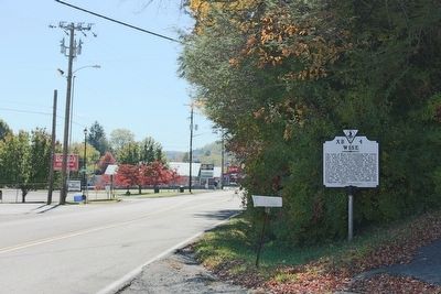
Location. 36° 58.923′ N, 82° 35.159′ W. Marker is in Wise, Virginia, in Wise County. Marker is on West Main Street (Business U.S. 23) west of Barker Avenue SW. Touch for map. Marker is in this post office area: Wise VA 24293, United States of America. Touch for directions.
Other nearby markers. At least 8 other markers are within 5 miles of this marker, measured as the crow flies. E.M. Fulton House (approx. 0.4 miles away); Gladeville in the Civil War (approx. half a mile away); a different marker also named Wise (approx. 0.6 miles away); Napoleon Hill (approx. 0.6 miles away); The University of Virginia’s College at Wise (approx. 1.6 miles away); Norton / Coeburn (approx. 3.3 miles away); Armed Forces Memorial (approx. 4.1 miles away); Norton (approx. 4.1 miles away). Touch for a list and map of all markers in Wise.
More about this marker. This marker replaced an earlier marker with the same title and number that read, “This town, one of the highest in Virginia, was built on land first owned by Pierre de Tarbeau, a French nobleman. Originally known as Big Glades, it became Gladesville in 1856. A first courthouse, built in 1858, was burned by Union troops. An action was fought here, July 7, 1863, between Confederates and Union raiders. The name was changed to Wise when the town was rechartered in 1928.”
Credits. This page was last revised on June 16, 2016. It was originally submitted on November 22, 2015, by J. J. Prats of Powell, Ohio. This page has been viewed 461 times since then and 60 times this year. Photos: 1, 2, 3. submitted on November 22, 2015, by J. J. Prats of Powell, Ohio.


