Downtown in Baltimore, Maryland — The American Northeast (Mid-Atlantic)
Old St. Paul's
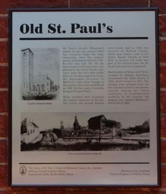
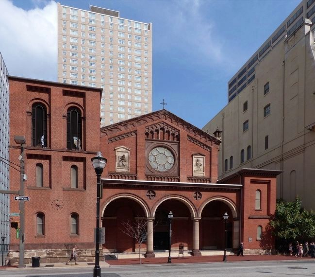
St. Paul's Church (Episcopal) stands on the only property that has remained under the same ownership since the original survey of Baltimore Town in 1730. In that year, Lot. No. 19, the highest point in the new town, was granted to St. Paul's Parish; nine years later, the city's first public place of worship opened its doors. All Episcopal churches in Baltimore trace their lineage to this parish, which was established in 1692, the first place of worship being in Patapsco Neck.
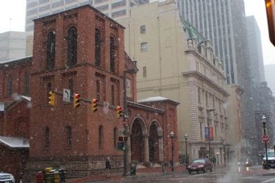
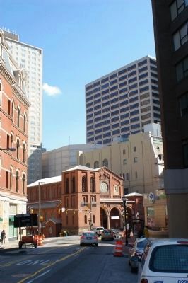
Three churches have succeeded the original structure on this lot. The fourth and present basilica style church, built in 1856, was designed by Richard Upjohn, the noted architect whose most famous work is the Gothic Trinity Church in New York. A six-story bell tower was part of the original plans for St. Paul's, but was never completed.
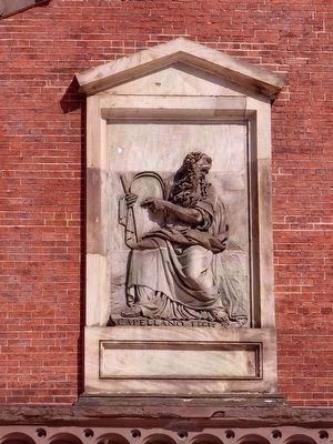
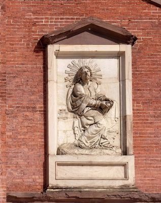
Marble reliefs of Moses and Christ, sculpted by Antonio Capellano, ornamented the third church of 1812, which burned in 1854. The plaques were salvaged from the fire and reinstalled on the present church. Among the oldest examples of architectural sculpture in the county, the plaques also escaped Baltimore's Great Fire of 1904.
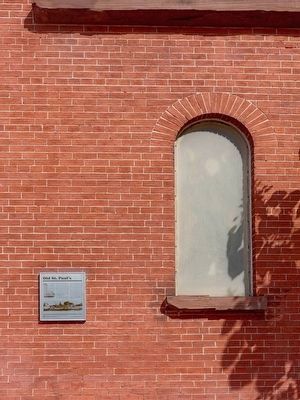
Erected 2008 by the City of Baltimore, The Vestry of St. Paul's Parish in Baltimore County, Inc., sponsor and William Donald Schaefer, mayor.
Topics and series. This historical marker is listed in these topic lists: Churches & Religion • Notable Buildings. In addition, it is included in the Maryland, Baltimore City historical markers series list. A significant historical year for this entry is 1730.
Location. 39° 17.52′ N, 76° 36.911′ W. Marker is in Baltimore, Maryland. It is in Downtown. Marker is at the intersection of North Charles Street and East Saratoga Street, on the right when traveling north on North Charles Street. Touch for map. Marker is in this post office area: Baltimore MD 21201, United States of America. Touch for directions.
Other nearby markers. At least 8 other markers are within walking distance of this marker. Saint Paul's Parish (a few steps from this marker); Downtown (within shouting distance of this marker); Moving Up To Cathedral Hill: Three Centuries of Change (within shouting distance of this marker); Brown's Loft Apartments (within shouting distance of this marker); Baltimore's City Center (within shouting distance of this marker); Charles Center & One Charles Center (about 400 feet away, measured in a direct line); Nancy D'Alesandro Pelosi (about 400 feet away); Mayor Thomas D'Alesandro, Jr. (about 400 feet away). Touch for a list and map of all markers in Baltimore.
More about this marker. On the left side of the marker is a drawing of "Upjohn's original design." At the bottom of the marker is a "view of the second church on this site."
Related marker. Click here for another marker that is related to this marker. This marker has replaced the linked marker.
Also see . . .
1. St. Paul's Episcopal Church (Baltimore, Maryland). Wikipedia entry (Submitted on December 4, 2023, by Larry Gertner of New York, New York.)
2. Built To Last: Old St. Paul's Episcopal Church. Historic American Buildings Survey (HABS) PDF (Submitted on January 20, 2016, by Allen C. Browne of Silver Spring, Maryland.)
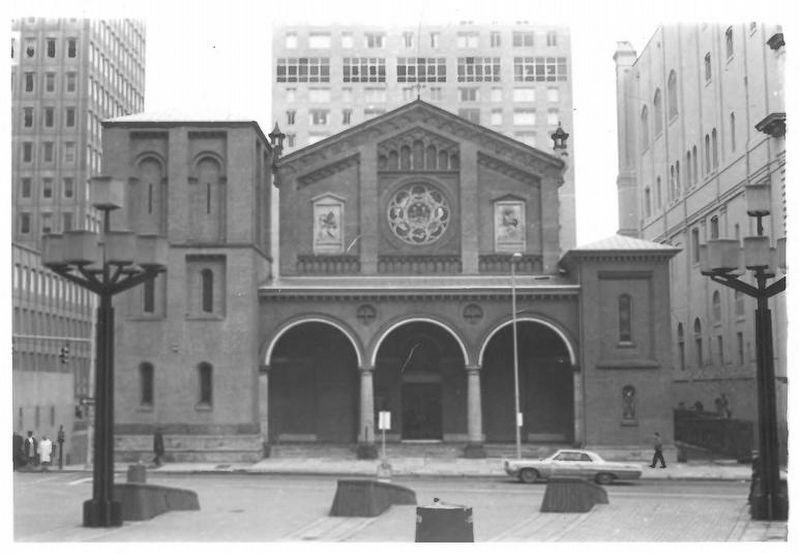
via NPS, unknown
3. St. Paul's Protestant Episcopal Church aka Old St. Paul's Church
National Register of Historic Places Nomination Form
NPGallery Digital Asset Management System
Click for more information.
NPGallery Digital Asset Management System
Click for more information.
Photographed By Allen C. Browne, September 5, 2015
8. Christ Breaking the Bread
Bas-relief by Antonio Capellano.
Bas-relief by Antonio Capellano.
These relief panels were part of the facade of the 1814 church building designed by Robert Cary Long, Sr. They survived the burning of that building on April 28, 1854. The present Richard Upjohn designed Church was built on the foundations of the 1814 Church in 1854.
Credits. This page was last revised on December 4, 2023. It was originally submitted on February 20, 2008, by Christopher Busta-Peck of Shaker Heights, Ohio. This page has been viewed 3,567 times since then and 37 times this year. Last updated on January 21, 2016, by Allen C. Browne of Silver Spring, Maryland. Photos: 1. submitted on June 8, 2008, by Christopher Busta-Peck of Shaker Heights, Ohio. 2. submitted on January 15, 2016, by Allen C. Browne of Silver Spring, Maryland. 3. submitted on December 4, 2023, by Larry Gertner of New York, New York. 4. submitted on February 20, 2008, by Christopher Busta-Peck of Shaker Heights, Ohio. 5. submitted on March 13, 2008, by Christopher Busta-Peck of Shaker Heights, Ohio. 6. submitted on January 15, 2016, by Allen C. Browne of Silver Spring, Maryland. 7, 8. submitted on January 20, 2016, by Allen C. Browne of Silver Spring, Maryland. • Bill Pfingsten was the editor who published this page.
