Jenner in Sonoma County, California — The American West (Pacific Coastal)
Fort Ross Chapel
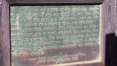
This chapel was a part of the settlement founded by the Russians in 1812 and known as Fort Ross. The fort was in the form of a quadrangle, about 300 feet square, inclosed by a redwood wall, with two blockhouses at opposite corners. Fort Ross contained fifty-nine buildings, nine of which, including this chapel, were within the inclosure. The Russians withdrew in 1841, selling their improvements and stock to John A. Sutter of Sutter's Fort. Property acquired by the State of California in 1906.
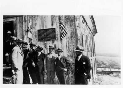
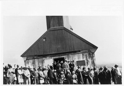
Erected 1928 by Historic Landmarks Committee, Native Sons of the Golden West.
Topics and series. This historical marker is listed in these topic lists: Forts and Castles • Settlements & Settlers. In addition, it is included in the Native Sons/Daughters of the Golden West series list. A significant historical year for this entry is 1812.
Location. 38° 30.871′ N, 123° 14.581′ W. Marker is in Jenner, California, in Sonoma County. Marker can be reached from Fort Ross Road, ¼ mile west of Coast Highway (California Route 1), on the left when traveling west. Fort Ross is on Fort Ross Road, about 11.5 miles north of Jenner, California at the mouth of the Russian River. Going north, turn left onto Fort Ross Road and in 1/4 mile turn left again into the parking lot. Touch for map. Marker is in this post office area: Jenner CA 95450, United States of America. Touch for directions.
Other nearby markers. At least 8 other markers are within walking distance of this marker. The Russian Cemetery (within shouting distance of this marker); The Russian Village Site - Sloboda (about 300 feet away, measured in a direct line); Fort Ross Defenses (about 300 feet away); Sandy Beach Cove (about 500 feet away); The Native Alaskan Village (about 600 feet away); Fort Ross Cove (about 600 feet away); California's First Windmill (about 700 feet away); The Call Family Residence (approx. 0.2 miles away). Touch for a list and map of all markers in Jenner.
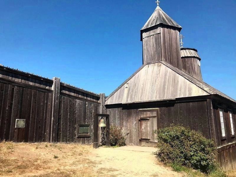
More about this marker. This marker is inside the stockade at Fort Ross State Historical Park. It is mounted on the inside wall of the fort, near the entrance to the chapel and, more-or-less, behind the framework that holds the chapel bell.
Also see . . . Fort Ross State Historic Park. California Department of Parks and Recreation website entry:
Fort Ross was a thriving Russian-American Company settlement from 1812 to 1841. This commercial company chartered by Russia's tsarist government controlled all Russian exploration, trade and settlement in the North Pacific, and established permanent settlements in Alaska and California. Fort Ross was the southernmost settlement in the Russian colonization of the North American continent, and was established as an agricultural base to supply Alaska. It was the site of California's first windmills and shipbuilding, and Russian scientists were among the first to record California’s cultural and natural history. Fort Ross was a successfully functioning multi-cultural settlement for some thirty years. Settlers included Russians, Native Alaskans and Californians, and Creoles (individuals of mixed Russian and native ancestry.) (Submitted on September 26, 2013, by James King of San Miguel, California.)
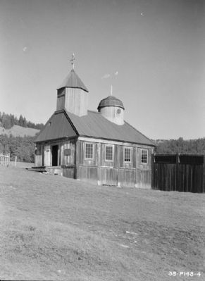
Photographed By Roger Sturtevant, February 10, 1934
3. View from South-West - Fort Ross, Russian Chapel, Fort Ross, Sonoma County, CA
The marker is visible here, just to the right of the chapel entrance, at what was probably its original location.
The chapel was nearly destroyed in the earthquake of April 1906, leaving only the roof and associated structures intact. The chapel was restored, 1915-1917, with significant additional alterations undertaken during repairs, 1955-57. Fire destroyed the chapel on October 5, 1970, with a complete reconstruction of the chapel completed on the same site in 1973. (Photo courtesy of the Historic American Building Survey)
The chapel was nearly destroyed in the earthquake of April 1906, leaving only the roof and associated structures intact. The chapel was restored, 1915-1917, with significant additional alterations undertaken during repairs, 1955-57. Fire destroyed the chapel on October 5, 1970, with a complete reconstruction of the chapel completed on the same site in 1973. (Photo courtesy of the Historic American Building Survey)
Credits. This page was last revised on November 30, 2023. It was originally submitted on September 26, 2013, by James King of San Miguel, California. This page has been viewed 622 times since then and 22 times this year. Last updated on March 8, 2016, by James King of San Miguel, California. Photos: 1. submitted on September 26, 2013, by James King of San Miguel, California. 2. submitted on July 14, 2020, by Diane Phillips of Pittsburg, California. 3. submitted on September 26, 2013. 4. submitted on September 26, 2013, by James King of San Miguel, California. 5. submitted on February 22, 2009, by Karen Key of Sacramento, California. 6, 7. submitted on March 8, 2016, by James King of San Miguel, California. 8. submitted on April 30, 2016, by James King of San Miguel, California. • Syd Whittle was the editor who published this page.
