Near Woodson in Young County, Texas — The American South (West South Central)
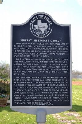
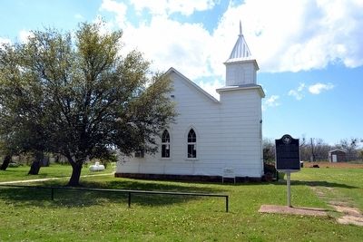
Murray Methodist Church
The Fish Creek Methodist Society was organized in 1886, and a circuit riding minister from the Throckmorton district served the little church. When the membership outgrew the cabin, services were held in a nearby school from 1893 until it burned in 1897. A new school was built, and the church met there until 1907.
The Fish Creek community became known as Murray when a new post office was established with that name. In 1907, the W.L. Chandler family donated land to the church, two miles west of the original log cabin site. The church, formerly known as the Methodist Episcopal Church South of Fish Creek, was called Chandler Chapel for a short time, then renamed Murray Methodist Church. A church building was erected, featuring many interior fixtures donated by members of the congregation. The church continues to be a vital part of the community.
Erected 1986 by Texas Historical Commission. (Marker Number 3540.)
Topics and series. This historical marker is listed in these topic lists: Churches & Religion • Settlements & Settlers. In addition, it is included in the United Methodist Church Historic Sites series list. A significant historical year for this entry is 1874.
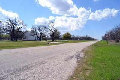
Location. 33° 3.383′ N, 98° 53.783′ W. Marker is near Woodson, Texas, in Young County. Marker can be reached from Farm to Market Road 209 west of Farm to Market Road 578, on the left when traveling west. Touch for map. Marker is in this post office area: Graham TX 76450, United States of America. Touch for directions.
Other nearby markers. At least 8 other markers are within 11 miles of this marker, measured as the crow flies. Tyra Graveyard - Murray Community Cemetery (approx. 2˝ miles away); Proffitt Cemetery (approx. 8.9 miles away); Proffitt Cemetery Veterans (approx. 9 miles away); Common Grave (approx. 9 miles away); In Memory of Proffitt, Carlton, and Johnson (approx. 9 miles away); Indian Raid on Elm Creek, C.S.A. (approx. 9 miles away); Military Road (Fort Belknap - Fort Phantom Hill) (approx. 11.1 miles away); Military Road (Fort Belknap - San Antonio) (approx. 11.1 miles away).
Also see . . . Murray, TX. From the Texas State Historical Association’s “Handbook of Texas Online”. (Submitted on April 3, 2016.)
Credits. This page was last revised on August 20, 2023. It was originally submitted on April 3, 2016, by Duane Hall of Abilene, Texas. This page has been viewed 386 times since then and 31 times this year. Photos: 1, 2, 3. submitted on April 3, 2016, by Duane Hall of Abilene, Texas.


