Near Albany in Shackelford County, Texas — The American South (West South Central)
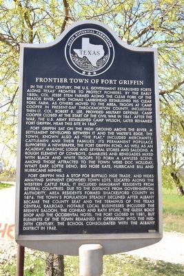
Frontier Town of Fort Griffin
Fort Griffin sat on the high ground above the river. A settlement developed between it and the water’s edge. The town, known also as “the Flat,” included merchants, cattlemen and their families. Its permanent populace supported a newspaper, the Fort Griffin Echo, as well as an academy, Masonic lodge and several stores and saloons. A rough element of cowboys, gamblers and renegades mixed with black and white troops to form a lawless scene. Among those attracted to the town were Doc Holliday, Wyatt Earp, Lottie Deno, Big Nose Kate, Hurricane Bill and Hurricane Minnie.
Fort Griffin was a stop for buffalo hide trade, and hides awaiting shipment crowded town lots. Located along the Western Cattle Trail, it included immigrant residents from several countries. Due to the distance from governmental authority, area residents formed Shackelford County in 1874. The town’s population steadily declined after Albany became the county seat and the terminus of the Texas Central Railroad. Notable local businesses included the Beehive saloon, the Conrad and Rath store, the Glesk boot shop and the Occidental hotel. The fort closed in 1881, but elements of the town remained in operation into the mid-20th century. The school consolidated with the Albany District in 1942.
Erected 2004 by Texas Historical Commission. (Marker Number 13028.)
Topics. This historical marker is listed in these topic lists: Forts and Castles • Settlements & Settlers. A significant historical year for this entry is 1867.
Location. 32° 55.924′ N, 99° 13.804′ W. Marker is near Albany, Texas, in Shackelford County. Marker is on County Road 184, 0.6 miles west of U.S. 283, on the left when traveling west. Touch for map. Marker is in this post office area: Albany TX 76430, United States of America. Touch for directions.
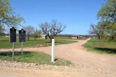
Other nearby markers. At least 8 other markers are within walking distance of this marker. The Western Cattle Trail Crossings at Fort Griffin (here, next to this marker); Fort Griffin Civil Jail (about 500 feet away, measured in a direct line); Fort Griffin Lodge Hall (about 700 feet away); Fort Griffin (approx. 0.4 miles away); Russell Young Gilbert
(approx. half a mile away); Civilian Conservation Corps at Fort Griffin (approx. 0.7 miles away); Family Forts, C.S.A. (approx. 0.8 miles away); Black Cemetery (approx. 0.9 miles away). Touch for a list and map of all markers in Albany.
Also see . . .
1. Fort Griffin, TX. From the Texas State Historical Association’s “Handbook of Texas Online”. (Submitted on April 5, 2016.)
2. The Post on Government Hill. From the Texas Beyond History website, an extensive web page with photos, illustrations, and maps of Fort Griffin, the town of Fort Griffin, and the Western Trail. (Submitted on April 5, 2016.)
Credits. This page was last revised on June 16, 2016. It was originally submitted on April 5, 2016, by Duane Hall of Abilene, Texas. This page has been viewed 492 times since then and 24 times this year. Photos: 1, 2, 3. submitted on April 5, 2016, by Duane Hall of Abilene, Texas.


