Forest in Buffalo in Erie County, New York — The American Northeast (Mid-Atlantic)
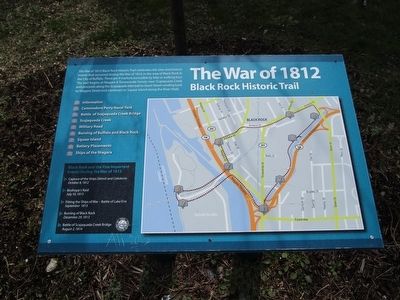
The War of 1812
Black Rock Historic Trail
1) Information
2) Commodore Perry Naval Yard
3) Battle of Scajaquada Creek Bridge
4) Scajaquada Creek
5) Military Road
6) Burning of Buffalo and Black Rock
7) Squaw Island
8) Battery Placements
9) Ships of the Niagara
Black Rock and the Five Important Events During the War of 1812
› Capture of the ships Detroit and Caledonia, October 8, 1812
› Bisshopp's Raid, July 10, 1813
› Fitting the Ships of War, September 1813
› Burning of Black Rock, December 29, 1813
› Battle of Scajaquada Creek Bridge, August 2, 1814
Topics. This historical marker is listed in this topic list: War of 1812. A significant historical date for this entry is July 10, 1813.
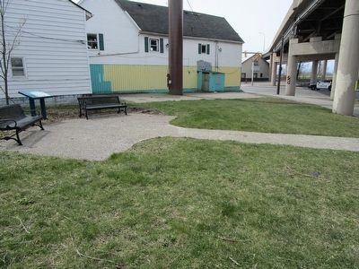
Location. 42° 55.69′ N, 78° 53.826′ W. Marker is in Buffalo, New York, in Erie County. It is in Forest. Marker is at the intersection of Niagara Street (New York State Route 266) and Forest Avenue, on the left when traveling south on Niagara Street. Marker is by the rear of the building at the intersection, at the south side of the Scajaquada Expressway overpass. Touch for map. Marker is in this post office area: Buffalo NY 14207, United States of America. Touch for directions.
Other nearby markers. At least 8 other markers are within walking distance of this marker. Porter Square (approx. 0.3 miles away); Unity Island (approx. 0.3 miles away); International Railroad Bridge (approx. 0.4 miles away); Thunder Over the Niagara (approx. half a mile away); Stephen W. Howell (approx. half a mile away); Jacob Smith House and Tavern (approx. half a mile away); St. John's Church (approx. half a mile away); Market Square (approx. half a mile away). Touch for a list and map of all markers in Buffalo.
Credits. This page was last revised on February 16, 2023. It was originally submitted on April 12, 2016, by Anton Schwarzmueller of Wilson, New York. This page has been viewed 490 times since then and 55 times this year. Photos: 1, 2, 3. submitted on April 12, 2016, by Anton Schwarzmueller of Wilson, New York.


