Hyde Park
Early Mormon Settlement
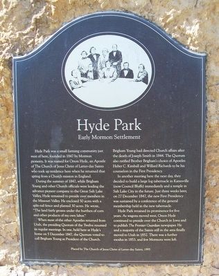
Hyde Park was a small farming community just west of here, founded in 1847 by Mormon pioneers. It was named for Orson Hyde, an Apostle of The Church of Jesus Christ of Latter-Day Saints who took up residence here when he returned that spring from a Church mission in England.
During the summer of 1847, while Brigham Young and other Church officials were leading the advance pioneer company to the Great Salt Lake Valley, Hyde remained to preside over members in the Missouri Valley. He enclosed 50 acres with a split-rail fence and planted 30 acres. He wrote, "The land fairly groans under the burthen of corn and other products of my own labor."
When most of the other Apostles returned from Utah, the presiding Quorum of the Twelve resumed its regular meetings. In one, held here at Hyde's home on 5 December 1847, the Quorum voted to call Brigham Young as President of the Church.
Brigham Young had directed Church affairs after the death of Joseph Smith in 1844. The Quorum also ratified Brother Brigham's choice of Apostles Heber C. Kimball and Willard Richards to be his counselors in the First Presidency.
In another meeting here the next day, they decided to build a large log tabernacle in Kanesville (now Council Bluffs) immediately and a temple in Salt Lake City in the future. Just three weeks later, on 27 December 1847,
the First Presidency was sustained by a conference of the general membership held in the new tabernacle.
Hyde Park retained its prominence for five years. As wagons moved west, Orson Hyde continued to preside over the Church in Iowa and to publish The Frontier Guardian newspaper. He and a majority of the Saints still in the area finally moved to Utah in 1852. There was a further exodus in 1853, and few Mormons were left.
Erected 1995 by The Church of Jesus Christ of Latter-Day Saints.
Topics and series. This historical marker is listed in these topic lists: Churches & Religion • Settlements & Settlers. In addition, it is included in the Mormon Pioneer Trail series list. A significant historical year for this entry is 1847.
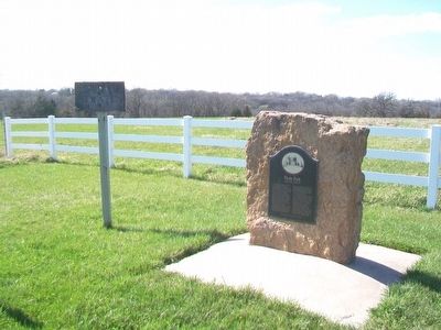
Location. 41° 10.648′ N, 95° 44.81′ W. Marker is near Council Bluffs, Iowa, in Pottawattamie County. Marker is on Dumfries Avenue, 1˝ miles south of Pioneer Trail, on the right when traveling south. Touch for map. Marker is at or near this postal address: 11212 Dumfries Avenue, Council Bluffs IA 51503, United States of America. Touch for directions.
Other nearby markers. At least 8 other markers are within 8 miles of this marker, measured as the crow flies. Kanesville Crossing: A Rush For Gold (approx. 1.4 miles away); Mormon Battalion Mustering Grounds (approx. 5.2 miles away); "Freedom With Honor" (approx. 7.3 miles away); Chicago, Rock Island & Pacific Railroad Depot
Also see . . .
1. Pushing on to Zion: Kanesville, Iowa, 1846-1853 (Hartley). (Submitted on April 16, 2016, by William Fischer, Jr. of Scranton, Pennsylvania.)
2. Mormon Pioneer National Historic Trail. (Submitted on April 16, 2016, by William Fischer, Jr. of Scranton, Pennsylvania.)
3. The First Mormon Tabernacle is Rebuilt in Kanesville, Iowa (Holmes). (Submitted on April 16, 2016, by William Fischer, Jr. of Scranton, Pennsylvania.)
Credits. This page was last revised on November 20, 2020. It was originally submitted on April 16, 2016, by William Fischer, Jr. of Scranton, Pennsylvania. This page has been viewed 620 times since then and 47 times this year. Photos: 1, 2. submitted on April 16, 2016, by William Fischer, Jr. of Scranton, Pennsylvania.

