Morton Grove in Cook County, Illinois — The American Midwest (Great Lakes)
Harrer Park
A Morton Grove Historical Site
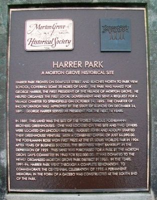
Harrer Park fronts on Dempster Street and reaches north to Park View School, covering some 20 acres of land. The park was named for George Harrer, the first president of the Village of Morton Grove. He helped organize the first local government and sent a request for a village charter to Springfield on October 24, 1895. The Charter of Incorporation was approved by the State of Illinois on December 24, 1895. George Harrer served as president for the next 14 years.
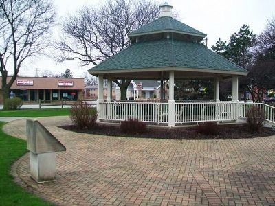
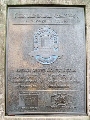
In 1889, this land was the site of the world famous Poehlmann Brothers greenhouses. One was located on this site and two others were located on Lincoln Avenue. August, John and Adolph started their greenhouse venture with a combined capital of just $6,090.00. The Poehlmann Rose won first prize at the St. Louis World's Fair in 1904. After years of business success, the brothers went bankrupt in the Depression of 1929. This land was purchased for a park by the Morton Grove Day's [sic] Committee in 1940 for $52,000.00. It was donated to the newly organized Morton Grove Park District in 1951. In the years, 1991-94, Harrer Park went through a complete renovation. To commemorate the centennial celebration of 1995, a permanent memorial in the form of a gazebo was constructed at the south end of the park.
Erected by Morton Grove Historical Society.
Topics. This historical marker is listed in these topic lists: Charity & Public Work • Horticulture & Forestry. A significant historical date for this entry is October 24, 1895.
Location. 42° 2.476′ N, 87° 46.958′ W. Marker is in Morton Grove, Illinois, in Cook County. Marker is at the intersection of Dempster Street (Illinois Route 58) and Fernald Avenue, on the right when traveling west on Dempster Street. Touch for map. Marker is at or near this postal address: 6210 West Dempster Street, Morton Grove IL 60053, United States of America. Touch for directions.
Other nearby markers. At least 8 other markers are within 2 miles of this marker, measured as the crow flies. Indian Trading Post (about 400 feet away, measured in a direct line); American Indian - Potawatomi Tribe Eagle Dancer (about 400 feet away); The American Legion Memorial (about 400 feet away); St. Peter's United Church of Christ (approx. 1.7 miles away); Historic Engine House (approx. 1.7 miles away); The Niles Center Wall (approx. 1.7 miles away); Holocaust Memorial (approx. 1.7 miles away); Historic Log Cabin (approx. 1.7 miles away). Touch for a list and map of all markers in Morton Grove.
Also see . . .
1. Harrer Park. Morton Grove Park District entry (Submitted on May 8, 2016, by William Fischer, Jr. of Scranton, Pennsylvania.)
2. Morton Grove IL History. Encyclopedia of Chicago entry (Submitted on May 8, 2016, by William Fischer, Jr. of Scranton, Pennsylvania.)
3. 1916 Poehlman Brothers Court Case. Wikisource entry (Submitted on May 8, 2016, by William Fischer, Jr. of Scranton, Pennsylvania.)
4. "Rooted in history, Morton Grove floral industry buckles under economy". Morton Grove Trib Local article; by Jason Lee, Oct. 14, 2009:
Highlights the Poehlman Brothers greenhouses (Submitted on May 8, 2016, by William Fischer, Jr. of Scranton, Pennsylvania.)
Credits. This page was last revised on May 25, 2023. It was originally submitted on May 8, 2016, by William Fischer, Jr. of Scranton, Pennsylvania. This page has been viewed 469 times since then and 25 times this year. Photos: 1, 2, 3. submitted on May 8, 2016, by William Fischer, Jr. of Scranton, Pennsylvania.


