Near Enoree in Spartanburg County, South Carolina — The American South (South Atlantic)
A Band of Brothers
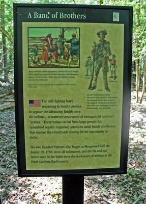
The two hundred Patriots who fought at Musgrove's Mill on August 19, 1780, were all militiamen, and the hit-and-run tactics used in the battle were the trademark of militias in the South Carolina Backcountry.
Erected by South Carolina State Park Service.
Topics. This historical marker is listed in this topic list: War, US Revolutionary. A significant historical date for this entry is August 19, 1780.
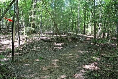
Location. 34° 35.873′ N, 81° 51.205′ W. Marker is near Enoree, South Carolina, in Spartanburg County. Marker can be reached from Horseshoe Falls Road (State Highway S-42-10) 1.4 miles south of State Highway 56, on the left when traveling south. This marker is one of a series along the Musgrove Mill Battlefield Trail. The trail starts at a parking area and leads to a loop where the main battle action occurred. It is approximately 1000 feet from the start of the trail. Touch for map. Marker is in this post office area: Enoree SC 29335, United States of America. Touch for directions.
Other nearby markers. At least 8 other markers are within walking distance of this marker. Americans in British Uniform (within shouting distance of this marker); Into the Backcountry (within shouting distance of this marker); True to Their King (about 300 feet away, measured in a direct line); A Bad Situation Gets Worse (about 600 feet away); Winning the Battle & the War (approx. 0.2 miles away); A Rare Glimpse of a Crucial Road (approx. 0.2 miles away); Inman's Men Bait the Trap (approx. 0.2 miles away); The Enemy Within (approx. ¼ mile away). Touch for a list and map of all markers in Enoree.
Regarding A Band of Brothers. The marker includes two illustrations by Don Troiani courtesy of National Park Service, Harpers Ferry Center.
At top left: Along with their unique appearance, militias often had unique styles of fighting, frequently posting themselves behind trees or fences, as pictured here. Notice, also, the different clothing of the militiamen.
At top right are drawings of Loyalist, Patriot and Provincial militiamen: Because militias had to supply themselves with everything they needed, they generally did not have uniforms. This image of a Pennsylvania rifleman shows how most militiamen would have dressed as they went into battle.
Additional keywords. battle
Credits. This page was last revised on June 16, 2016. It was originally submitted on June 1, 2016, by David Graff of Halifax, Nova Scotia. This page has been viewed 419 times since then and 34 times this year. Photos: 1, 2. submitted on June 1, 2016, by David Graff of Halifax, Nova Scotia. • Bernard Fisher was the editor who published this page.

