Near Alexandria in Fairfax County, Virginia — The American South (Mid-Atlantic)
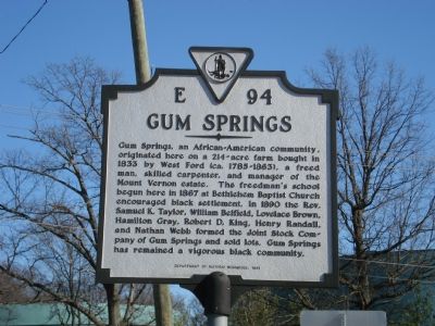
Gum Springs
Erected 1991 by Department of Historic Resources. (Marker Number E-94_1.)
Topics and series. This historical marker is listed in these topic lists: African Americans • Churches & Religion • Education • Industry & Commerce • Settlements & Settlers. In addition, it is included in the Virginia Department of Historic Resources (DHR) series list. A significant historical year for this entry is 1833.
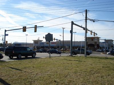
Location. 38° 44.909′ N, 77° 4.965′ W. Marker is near Alexandria, Virginia, in Fairfax County. Marker is at the intersection of Fordson Road and Richmond Highway (U.S. 1), on the right when traveling west on Fordson Road. Touch for map. Marker is at or near this postal address: 7717 Richmond Hwy, Alexandria VA 22306, United States of America. Touch for directions.
Other nearby markers. At least 8 other markers are within walking distance of this marker. West Ford (within shouting distance of this marker); Hybla Valley Airport (about 600 feet away, measured in a direct line); Woodlawn Methodist Church (about 600 feet away); Harper v. Virginia Board of Elections (about 600 feet away); Bethlehem Baptist Church (approx. 0.3 miles away); a different marker also named Gum Springs (approx. 0.4 miles away); US Route 1 Wall of Aviation (approx. half a mile away); Peake Family Cemetery (approx. 0.8 miles away). Touch for a list and map of all markers in Alexandria.
Also see . . .
1. Gum Springs Museum. (Submitted on January 12, 2021, by Allen C. Browne of Silver Spring, Maryland.)
2. Marker replaced for third time.
Years apart, the marker was knocked down twice by passing cars. The new marker, installed on April 21, 2021, is on a hill above the roadway and hopefully out of danger.(Submitted on April 30, 2021, by Mark Hilton of Montgomery, Alabama.)
Credits. This page was last revised on November 12, 2022. It was originally submitted on April 16, 2007, by Roger Dean Meyer of Yankton, South Dakota. This page has been viewed 3,052 times since then and 114 times this year. Photos: 1, 2. submitted on April 16, 2007, by Roger Dean Meyer of Yankton, South Dakota. 3. submitted on January 12, 2021, by Allen C. Browne of Silver Spring, Maryland. • J. J. Prats was the editor who published this page.
Editor’s want-list for this marker. Photo and GPS coordinates of marker in new nearby location. • Can you help?


