Near Dubois in Fremont County, Wyoming — The American West (Mountains)
Tie Hack Memorial
Railroads and the West
Photographed By Barry Swackhamer, May 30, 2016
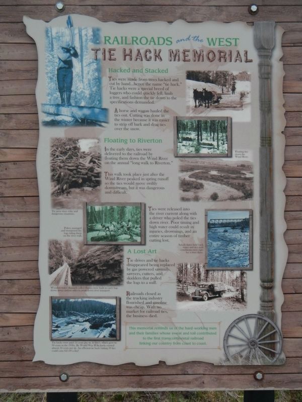
1. Tie Hack Memorial Marker
Captions: (left side, top to bottom) Tie jams were risky and dangerous situations.; Polers managed and monitored the logs riding them on the river walk.; Wooden water channels called flumes were built to carry logs down steep canyons sides to await down river transport.; Tie hacks were paid 12 cents per tie in 1913, which grew to 30 cents in the 1930s. By World War II tie hacks earned almost 50 cents per tie. An efficient tie hack cutting 50 ties could earn $25.00 a day!; (right side, top to bottom) Floating ties down the Wind River.; Splash dams held back water and ties until conditions were right for a river drive.
Ties were made from trees hacked and cut by hand...hence the name "tie hack." Tie hacks were a special breed of loggers who could quickly fell, limb a tree, and fashion the tie down to the specification demanded.
A horse and wagon hauled the ties out. Cutting was done in the winter because it was easier to strip off bark and drag ties over the snow.
In the early days, ties were delivered to the railroad by floating them down the Wind River on the annual "long walk to Riverton."
This walk took place just after the Wind River peaked in spring runoff so the ties would move swiftly downstream, but it was dangerous and difficult.
Tie drives and tie hacks disappeared being replaced by gas powered sawmills, sawyers, cutters, and skitters that pulled the logs to a mill.
Railroads closed as the trucking industry flourished and gasoline was cheap. With no market for railroad ties, the business died.
Erected by Shoshone National Forest.
Topics. This historical marker and memorial is listed in this topic list: Industry & Commerce.
Location. 43° 38.796′ N, 109° 55.584′ W. Marker is near Dubois, Wyoming, in Fremont County. Marker is on U.S. 287 near Warm Springs Creek Road, on the left when traveling west. Touch for map. Marker is at or near this postal address: 3821 US Highway 287, Dubois WY 82513, United States of America. Touch for directions.
Other nearby markers. At least 8 other markers are within 12 miles of this marker, measured as the crow flies. Union Pass (approx. 7.8 miles away); a different marker also named Union Pass (approx. 7.8 miles away); The Great Divide (approx. 10.2 miles away); Leading the Way (approx. 10.3 miles away); Fauna of Union Pass (approx. 11.7 miles away); Cultural Heritage (approx. 11.7 miles away); The Rendezvous (approx. 11.7 miles away); a different marker also named Union Pass (approx. 11.7 miles away). Touch for a list and map of all markers in Dubois.
Photographed By Barry Swackhamer, May 30, 2016
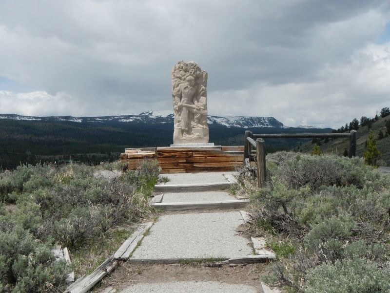
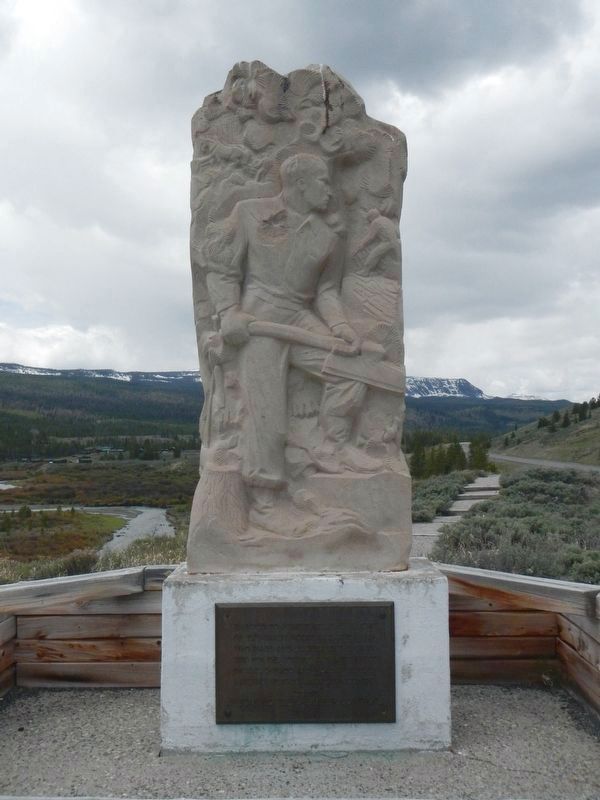
4. Tie Hack Monument
The plaque below reads:
Erected to perpetuate the memory of the hardy woods and river men who made and delivered the cross ties for the building and maintenance of the Chicago and North Western Railway in this western county.
Wyoming Tie & Timber Company 1946
Wyoming Tie & Timber Company 1946
Photographed By Barry Swackhamer, May 30, 2016
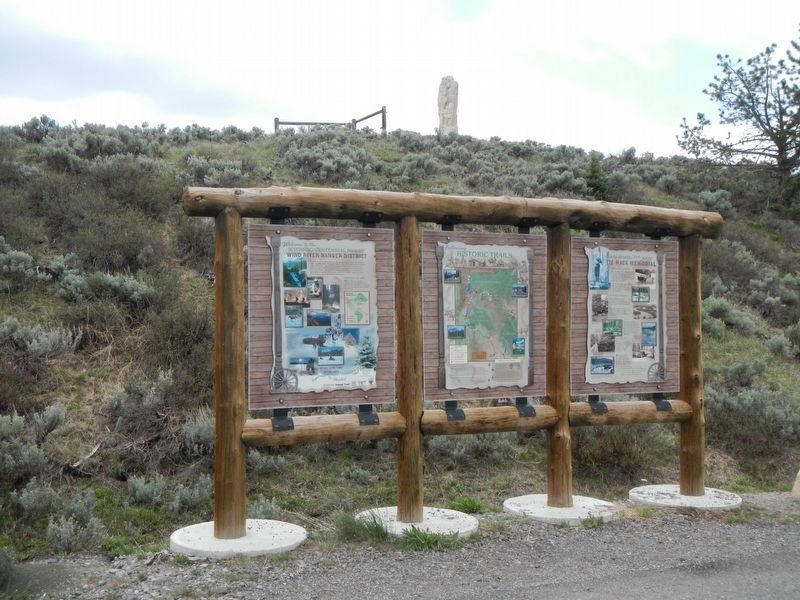
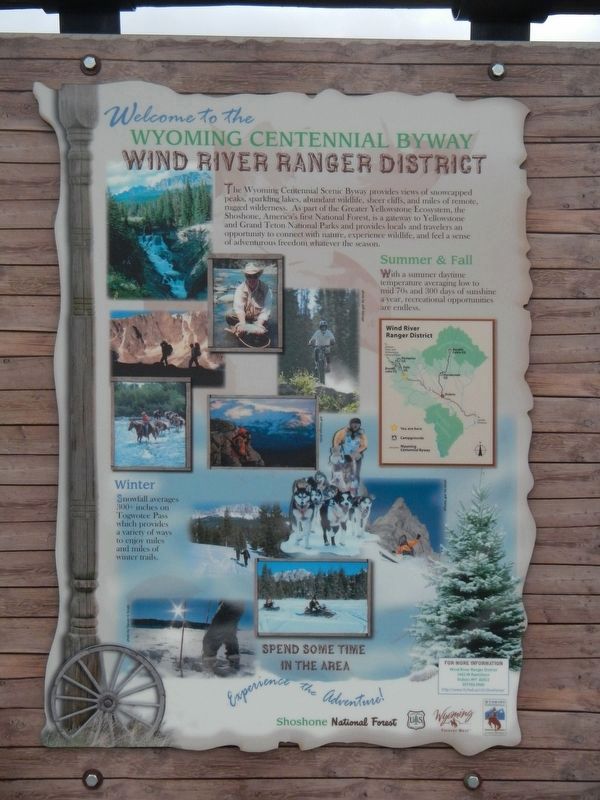
5. Welcome to the Wyoming Centennial Byway
The Wyoming Centennial Scenic Byway provides views of snowcapped peaks, sparkling lakes, abundant wildlife, sheer cliffs, and miles of remote rugged wilderness. As part of the Greater Yellowstone Ecosystem, the Shoshone, Americas's first National Forest, is a gateway to Yellowstone and Grand Teton National Parks and provides locals and travelers an opportunity to connect with nature, experience wildlife, and feel a sense of adventurous freedom whatever the season.
Summer & Fall
With a summer daytime temperature averaging low to mid 70s and 300 days of sunshine a year, recreational opportunities are endless.
Winter
Snowfall averages 300+ inches on Togwotee Pass which provides a variety of ways to enjoy miles and miles of winter trails.br
Spend Some Time in the Area
Photographed By Barry Swackhamer, May 30, 2016
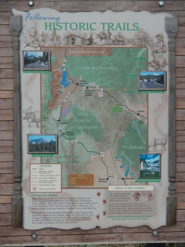
6. Following Historic Trails
Along the Road
U.S. Highway 26/287 crosses the Continental Divide and heads west to Grand Teton National Park and Yellowstone National Park The drive offers a little-known and real-life patch of the legendary West with spectacular vies. Along the way, stop in at the local guest ranches and lodges for an overnight stay.
The highway winds through broad valleys, pine forests and mountain scenes to the summit, where the Pinnacles - a series of jagged peak - rise to crown the ridge and beyond to the Continental Divide at Togwotee Pass (elevation 9,658 feet). You might see patches of snow at the divide!
Captions: (top left) The Breccia Cliffs from Togwotee Pass; (top right) Lava Mountains on Togwotee Pass; (bottom right) Approaching Dunwoody Glacier in the rugged Fitzpatrick Wilderness; (bottom left) Pinnacles at Togwotee Pass.
Credits. This page was last revised on August 1, 2016. It was originally submitted on July 30, 2016, by Barry Swackhamer of Brentwood, California. This page has been viewed 815 times since then and 33 times this year. Photos: 1, 2, 3, 4, 5, 6. submitted on July 30, 2016, by Barry Swackhamer of Brentwood, California.
