Near Worland in Washakie County, Wyoming — The American West (Mountains)
Colby Mammoth Kill Site
Inscription.
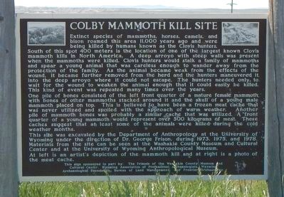
Extinct species of mammoths, horses, camels, and bison roamed this area 11,000 years ago and were being killed by humans known as the Clovis hunters. South of this spot 400 meters is the location of one of the largest known Clovis mammoth kills in North America. A deep arroyo with steep walls was present when the mammoths were killed. Clovis hunters would stalk a family of mammoths and spear a young animal that was careless enough to wander away from the protection of the family. As the animal became weak from the effects of the wound, it became further removed from the herd and the hunters maneuvered it into the deep arroyo where it could not escape. The hunters needed only to wait for the wound to weaken the animal enough that it could easily be killed. This kind of event was repeated many times over the years.
One pile of bones consisted of the left front quarter of a mature female mammoth with bones of other mammoths stacked around it and the skull of a young male mammoth placed on top. This is believed to have been a frozen meat cache that was never utilized and spoiled with the approach of warm weather. Another pile of mammoth bones was probably a similar cache that was utilized. A front quarter of a young mammoth would represent over 500 kilograms of meat. These caches suggest that at least some of the animals were killed during the cold weather months.
This site was excavated by the Department of Anthropology at the University of Wyoming under the direction of Dr. George Frison during 1973, 1975, and 1978. Materials from the site can be seen at the Washakie County Museum and Cultural Center and at the University of Wyoming Anthropological Museum. At left is an artist's depiction of the mammoth kill and at right is a photo of the meat cache.
Erected by Wyoming State Historic Preservation Office.
Topics. This historical marker is listed in this topic list: Paleontology.
Location. 44° 1.44′ N, 107° 52.02′ W. Marker is near Worland, Wyoming, in Washakie County. Marker is on U.S. 16 near Cactus Drive, on the left when traveling west. Touch for map. Marker is at or near this postal address: 846 US Highway 16, Worland WY 82401, United States of America. Touch for directions.
Other nearby markers. At least 7 other markers are within 6 miles of this marker, measured as the crow flies. Welcome to Worland, Wyoming (approx. 4.4 miles away); Trail of the Whispering Giants (approx. 4.4 miles away); Pioneer Square (approx. 4˝ miles away); Jim Bridger Historic Trail (approx. 5.2 miles away); Worland Sugar Factory (approx. 5.6 miles away); C.H. "Dad" Worland (approx. 5.6 miles away); Worland: Original Town Site (approx. 5.6 miles away).
More about this marker. This marker is about 4 miles east of Worland.
Also see . . . Colby Clovis Mammoth Kill Site. The Colby site is located on private property in north central Wyoming in the Bighorn Basin. This important site was named after Donald Colby who discovered the first Clovis spear point there in 1962. Mr. Colby found it while using heavy earth moving equipment during the construction of a reservoir. (Submitted on September 16, 2016, by Barry Swackhamer of Brentwood, California.)
Credits. This page was last revised on September 16, 2016. It was originally submitted on September 16, 2016, by Barry Swackhamer of Brentwood, California. This page has been viewed 1,469 times since then and 68 times this year. Photos: 1, 2. submitted on September 16, 2016, by Barry Swackhamer of Brentwood, California.

