Thurmond in Fayette County, West Virginia — The American South (Appalachia)
Thurmond, West Virginia
New River Gorge National River
ó National Park Service, U.S. Department of the Interior ó
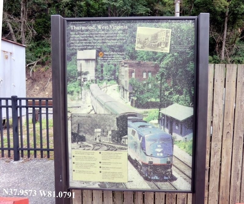
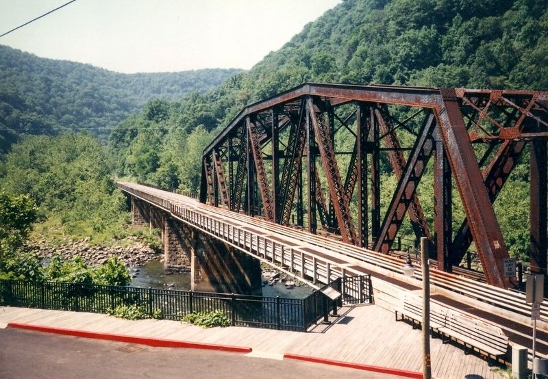
Here in Thurmond you can recall the vital role that railroads played in the growth and prosperity of America. For more than 80 years Thurmondís railroads thrived. Amid the remnants of this once-bustling town, you can imagine the sounds of steam whistles and the clickety-clack of wheel on rail.
Stay off the tracks! The tracks are still active. If you walk into town, be alert for trains and cross the railroad tracks only at the road crossing.
1. Water from the Water Column was poured into the tender behind the steam engine to produce the steam for power.
2. Engines took on sand at the Sanding Tower. To gain traction on slippery track, sand was dropped onto the track in front of the drive wheels.
3. The Engine House was used for servicing and repairing steam engines.
4. At the Coaling and Sanding Station, the steam engineís tender was located with coal for fuel. Sand was stored here for later transfers to the sanding tower.
5. Commercial Row housed the many town businesses.
6. Water Tanks stored water pumped from the river.
7. The Railroad Commissary supplied railroad workers with all their needs, including meat, clothing, boots, shovels, and hardware. Charges were deducted from the workerís pay.
[Caption:]
Ribbons of steel were ó and still are ó Thurmondís main street. This postcard photo was taken around 1930.
Erected by National Park Service, U.S. Department of the Interior.
Topics. This historical marker is listed in these topic lists: Industry & Commerce • Railroads & Streetcars. A significant historical year for this entry is 1930.
Location. Marker has been permanently removed. It was located near 37° 57.438′ N, 81° 4.746′ W. Marker was in Thurmond, West Virginia, in Fayette County. Marker was on Thurmond Road. The marker is near the New River Gorge National River visitor center. Touch for map. Marker was at or near this postal address: 254 River Crest Rd, Thurmond WV 25936, United States of America.
We have been informed that this sign or monument is no longer there and will not be replaced. This page is an archival view of what was.
Other nearby markers. At least 8 other markers are within walking distance of this location. A different marker also named Thurmond, West Virginia (here, next to this marker); New River Gorge National River (a few steps from this marker); A Railroad Town (within shouting distance of this marker); Where It All Starts (within shouting distance of this marker); Over the River (within shouting distance of this marker); 1869 (within shouting distance of this marker); 1873 (within shouting distance of this marker); a different marker also named 1873 (within shouting distance of this marker). Touch for a list and map of all markers in Thurmond.
Credits. This page was last revised on March 8, 2024. It was originally submitted on November 26, 2016, by Don Morfe of Baltimore, Maryland. This page has been viewed 408 times since then and 33 times this year. Last updated on March 7, 2024, by Craig Doda of Napoleon, Ohio. Photos: 1, 2, 3, 4, 5, 6. submitted on November 26, 2016, by Don Morfe of Baltimore, Maryland. • Devry Becker Jones was the editor who published this page.
