On Constitution Way, on the right when traveling north.
Following the 10 June 1861 Battle of Big Bethel, Maj. Gen. John B. Magruder, commander of the Confederate Army of the Peninsula, organized the construction of three defensive lines of fortifications across the peninsula. The main line extended 12 . . . — — Map (db m180518) HM
On Constitution Way, on the right when traveling east. Reported missing.
From this rifle pit, Colonel Hiram Berdan’s 1st U.S. Sharpshooters targeted Confederate troops on the opposite bank of the Warwick River. Hiram Berdan, considered the nation’s best marksman, organized the regiment from hand-picked volunteers who . . . — — Map (db m200060) HM
Near Constitution Way, on the right when traveling east.
George Armstrong Custer had the dubious honor of graduating last in the 1861 class at West Point. He was commissioned a second lieutenant in the 5th U.S. Cavalry and fought with the Army of the Potomac in almost every major battle from Bull Run to . . . — — Map (db m180521) HM
Near Constitution Way, on the right when traveling east.
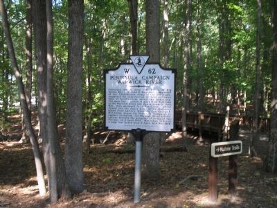
On April 4, 1862, Major General George B. McClellan launched his offensive on the Virginia Peninsula against the Confederate capital at Richmond. Major General John B. Magruder’s 13,000 troops halted the Union advance along the Warwick-Yorktown line . . . — — Map (db m11254) HM
On Constitution Way, on the left when traveling east.
You are presently standing at the site of Dam No. 1, one of three dams constructed by Confederate commander John Bankhead Magruder to make the sluggish Warwick River into a defensive barrier. Dam No. 1 was the mid-point between two prewar tide . . . — — Map (db m180517) HM
Near Constitution Way, on the left when traveling east.
The twelve miles of Confederate defenses followed the course of the Warwick River one mile from Yorktown to Mulberry Island. Dam No. 1, the mid-point, was protected by this one-gun battery mounting a 12-pound howitzer. In addition, a 6-pound . . . — — Map (db m200062) HM
Near Constitution Way, on the left when traveling east.
Brigadier General William Smith massed 18 cannons in an open field within 500 yards of the opposite shore. In addition, General Smith deployed Brigadier General William T.H. Brooks’s Vermont Brigade along the Warwick River with two brigades in . . . — — Map (db m200063) HM
Near Constitution Way, on the left when traveling east.
The Vermont troops waited in vain for reinforcements; Corporal Alonzo Hutchinson was mortally wounded while crossing the Warwick River and died without signaling for support. The Union leaders also failed to exploit the break in the Confederate . . . — — Map (db m200066) HM
On Constitution Way, on the left when traveling east.
After the 15th North Carolina’s repulse, Brigadier General Howell Cobb (a former governor of Georgia and secretary of treasury) rallied the Confederates and prepared to drive the Vermonters into the water. Cobb commanded a brigade in Brigadier . . . — — Map (db m200069) HM
Near Constitution Way, on the left when traveling east.
The Battle of Dam No. 1 proved a lost opportunity for the Union Army to break the Warwick-Yorktown line and force a Confederate withdrawal toward Richmond. Instead, Major General George McClellan spent another 17 days completing his heavy artillery . . . — — Map (db m200070) HM
On Constitution Way, on the left when traveling east.
A stalwart defense of the Warwick River by units of the 15th North Carolina, 7th Georgia and 2nd Louisiana Infantry, C.S.A., commanded by General J.B. Magruder is commemorated here. The defensive line extending across the Virginia Peninsula was held . . . — — Map (db m10340) HM