On Jefferson Avenue at West First Avenue, on the left when traveling south on Jefferson Avenue.
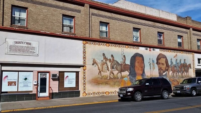
In the late Spring of 1855, representatives from the major tribes of Washington Territory gathered in council at Walla Walla. Chief Ka-Mi-Akin was the leader of the Confederacy of Tribes & Bands. The Yakima Treaty created a reservation of . . . — — Map (db m129697) HM
On South Toppenish Avenue south of South Division Street, on the right when traveling south.
Born to parents who arrived in the valley by covered wagon, “Lou” Shattuck grew up here. He loved horses and at age 15 was driving a stage coach. Famous for his six horse hitch, he won many gold medals, blue ribbons and cash prizes. Lou . . . — — Map (db m129698) HM
On Washington Avenue at South Toppenish Avenue, on the left when traveling south on Washington Avenue.
In the early days of Toppenish history the settlers worked from sunrise to sunset for weeks at a time. Each family pulled and burned acres of sagebrush and greasewood to make room to plant their crops. We salute these pioneers of our area.
This . . . — — Map (db m129699) HM
Near South Toppenish Avenue south of South Division Street, on the left when traveling north.
Charlie Newell’s knowledge of the Indian language and his wide acquaintance with the Yakama Indians enabled him to avert a crisis in which a massacre seemed imminent. The Indian Agency had forbidden the racing of horses and gambling at their meets. . . . — — Map (db m129700) HM
On South Division Street south of South Toppenish Avenue, on the right when traveling south.
Hops, potatoes, hay, wheat, melons and row crops all were shipped from this area in the early days of Toppenish. Artist Robert Thomas of Kooskia, Idaho shows the various ways the produce was moved at that time.
The Toppenish Mural . . . — — Map (db m129759) HM
On South Toppenish Avenue north of South Division Street, on the right when traveling south.
During the long cold winters, the Indian braves spent time hunting, and the women handled the cooking and clothing. The winter lodge was the gathering place for social functions. Painted in the summer of 1992 by Bothell, Washington artist Hulan . . . — — Map (db m129760) HM
On South Toppenish Avenue at South Division Street, on the right when traveling south on South Toppenish Avenue.
In 1884 Charley Newell, a Toppenish pioneer, drove 700 horses from this area to Kearny, Nebraska, which was the nearest railhead at that time. During the following years these horses were involved in four wars around the globe. Painted by Don Crook, . . . — — Map (db m129761) HM
On South Toppenish Avenue north of Washington Avenue, on the right when traveling north.
Indian tribes from throughout the Northwest gathered to pick hops by hand. Hop growing in Washington State started in the early 1800's. During the daylight hours, the hops were picked and the evenings were spent in relaxation such as playing the . . . — — Map (db m129762) HM
On South Toppenish Avenue at South Division Street, on the left when traveling north on South Toppenish Avenue.
In the years gone by the entire potato crop was picked from the field by hand. It was backbreaking work and took strong men and women to do the job. Potatoes were one of the first crops to be raised in this valley when it was settled.
Fred . . . — — Map (db m129763) HM
On South Alder Street south of West 1st Avenue, on the right when traveling north.
Originally called the "Fall Roundup," the rodeo has been part of the history of Toppenish since the late 1800's. In 1913 it was changed to "Rodeo" and later to "Pow Wow & Rodeo." This old worn poster brings back many fond memories of past rodeos to . . . — — Map (db m129764) HM
On South Toppenish Avenue south of Washington Avenue, on the right when traveling south.
The patterns on these Pendleton blankets were taken from a 1905 catalog. They are authentic. Painted by artist Robert Morgan of Clancy, Montana in May of 1992. The traders of that era were the first whites to befriend the Indians.
The . . . — — Map (db m129765) HM
On South Toppenish Avenue south of South Division Street, on the right when traveling south.
The Toppenish area around the 1890’s had 4 blacksmith shops. These shops were the hub of activity at that time. Rebuilding a wheel for a freight wagon, shoeing horses or making new parts for machinery the “smithy” was there. These were . . . — — Map (db m129766) HM