2 entries match your criteria.
Related Historical Markers
By Cosmos Mariner, July 2, 2015
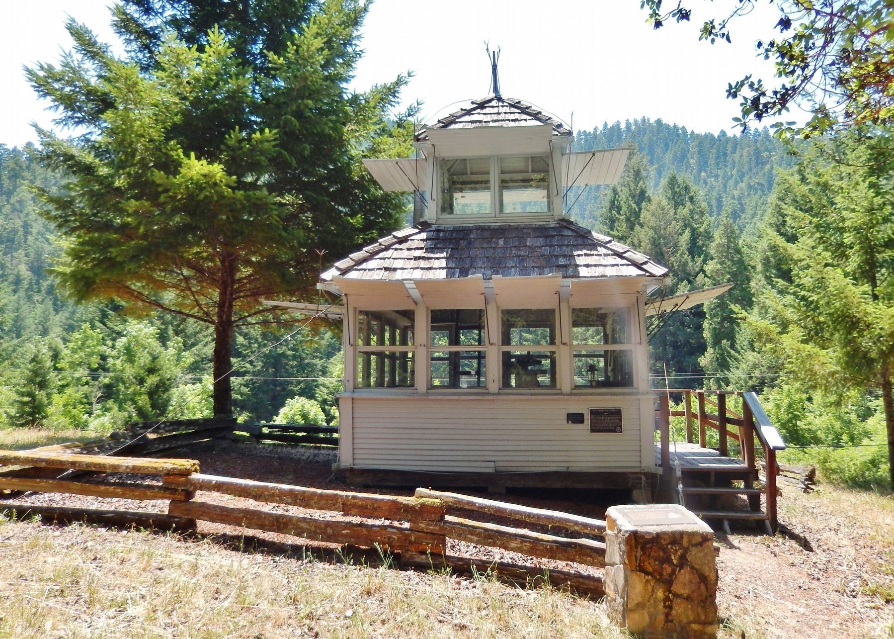
Red Mountain Lookout Marker (wide view; marker on pedestal; lookout in background)
SHOWN IN SOURCE-SPECIFIED ORDER
| Near Tiller Trail Highway (Oregon Route 227) at Avery Berry Loop (Forest Road 1600), on the right when traveling north. |
| |
In 1921 the Forest Service began, using a lookout tree on the Red Mountain in the upper Cow Creek Valley to detect fires in the surrounding mountains and valleys.
The tree was replaced by a cupola style lookout in 1928. This building was moved . . . — — Map (db m113334) HM |
| Near Tiller Trail Highway (Oregon Route 227) at Avery Berry Loop (Forest Road 1600) when traveling north. |
| |
These buildings, constructed by the Civilian Conservation Corps (CCC) during the period between 1933 – 1942, are excellent examples of the Depression-era, rustic style of U.S. Forest Service structures.
The building in the upper left . . . — — Map (db m113336) HM |
May. 23, 2024