4 entries match your criteria.
Related Historical Markers
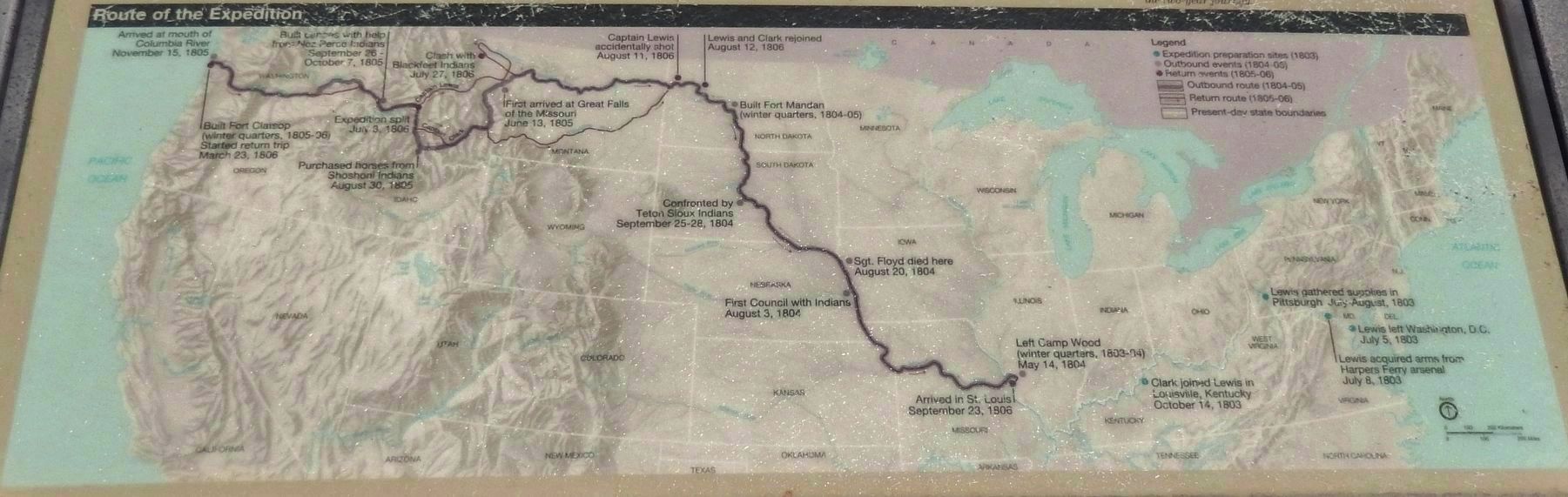
Marker detail: Lewis and Clark Expedition Map
SHOWN IN SOURCE-SPECIFIED ORDER
| 1 ► South Dakota, Stanley County, Fort Pierre — The Lewis and Clark Expedition — |
| Near 2 Rivers Street north of Ash Avenue. | |||
| 2 ► South Dakota, Hughes County, Pierre — Lewis & Clark Trail — Griffin Park — |
| Near Parkwood Drive, 0.2 miles south of East Dakota Avenue, on the right when traveling south. | |||
| 3 ► South Dakota, Stanley County, Fort Pierre — Lewis and Clark First Sioux Nation Meeting — |
| Near 2 Rivers Street north of Ash Avenue. | |||
| 4 ► South Dakota, Hughes County, Pierre — Lewis and Clark — |
| On West Dakota Avenue at James Street, on the left when traveling south on West Dakota Avenue. | |||