4 entries match your criteria.
Related Historical Markers
By Anton Schwarzmueller, August 8, 2020
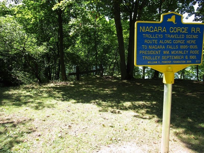
Niagara Gorge R.R. Marker
SHOWN IN SOURCE-SPECIFIED ORDER
| Near South 4th Street, 0.2 miles south of Tuscarora Street. |
| Near Discovery Way, 0.2 miles north of Main Street (New York State Route 104). Reported missing. |
| Near South 4th Street, 0.2 miles south of Tuscarora Street. |
| On Center Street (New York State Route 18F) at South 9th Street, on the right when traveling east on Center Street. |
Jun. 15, 2024