2 entries match your criteria.
Related Historical Markers
By Bill Coughlin, June 24, 2009
Marker in Downtown Manhattan
SHOWN IN SOURCE-SPECIFIED ORDER
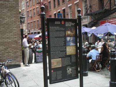
| 1 ► New York, New York County, Manhattan, Financial District — Stone Street Historic District and Colonial New York Street Plan — Exploring Downtown — Reported permanently removed |
| Stone Street Historic District The cluster of buildings along winding Stone, South William, and Pearl Streets and Coenties Alley forms one of Downtown’s last oases of early 19th-century New York. Stone Street’s stores and lofts were built for . . . — — Map (db m127710) HM | |||
| 2 ► New York, New York County, Manhattan, Financial District — Dutch Hoog Straat — |
| This map, derived from a 1600 drawing, shows Stone Street, then the Dutch Hoog Straat. Its original line is indicated by brown paving stones & the lobby alignment. — — Map (db m47376) HM | |||