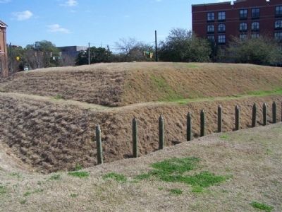
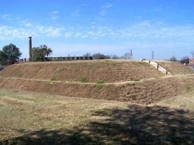
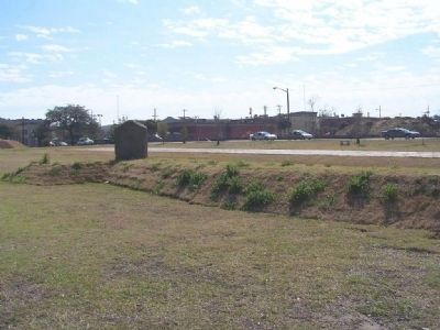
Yamacraw Village in Savannah in Chatham County, Georgia — The American South (South Atlantic)
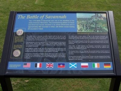
The Battle of Savannah
The British victory in Savannah rekindled England's spirit for the war, in part because the victory defeated troops of the regular army of France as well as American rebels. The battle marked the first time French regular army units fought on American soil in the Revolutionary War.
The international conflict that most Americans call the Revolutionary War involved British, French, Hessian, Irish, Polish, Haitian, Spanish, Dutch, Scottish, Native Americans and Americans of European and African heritage,many of whom were represented in Savannah.
Polish nobleman Casimir Pulaski, who held a brigadier general's commission from Congress, had fought unsuccessfully for Polish independence. He commanded the American cavalry and lost his life from a wound he received in the battle.
A young Henry Christophe participated with the allied army in Savannah. He went on to fight for the independence of Haiti from France and later became King Henry I of Haiti. He was one of the first heads of state of African descent in the Western Hemisphere.
The largest unit of black soldiers to fight in the American Revolution, the Chasseurs- Volontaires de Saint-Domingue (now Haiti), fought in Savannah. Many of these free men and volunteers went on to lead Haiti's fight for independence.
British Major General Augustin Prevost was a Swiss professional soldier of French Huguenot descent with a French wife. His loyalty to the British Crown was never questioned.
Arthur Dillon, an Irish nobleman and expatriate, commanded a regiment that included Irish soldiers serving the King of France. He and his regiment were prominent in the Battle of Savannah.
The Swedish Baron Curt von Stedingk was wounded leading a French column in the attack. He was intimate in the court of Gustavus III, Louis XVI and Catherine the Great.
The day before the battle, Pierre Charles L'Enfant, who later designed Washington, D.C., tried to dismantle and set fire to the abatis, a barrier of sharpened tree limbs designed to slow attackers.
(Bottom)
Ancestors of people represented by these modern flags fought in the Battle of Savannah.
[ Flags: United States, France, United Kingdom, Haiti, Scotland, Poland, Ireland, Germany ]
Erected 2008 by the City of Savannah, Sons of the Revolution in the State of Georgia.
Topics. This historical marker is listed in this topic list: War, US Revolutionary. A significant historical year for this entry is 1779.
Location. 32° 4.535′ N, 81° 5.959′ W. Marker is in Savannah, Georgia, in Chatham County. It is in Yamacraw Village. Marker is at the intersection of Martin Luther King Boulevard (West Broad Street) and Louisville Road, on the right when traveling south on Martin Luther King Boulevard (West Broad Street). Touch for map. Marker is at or near this postal address: 303 Martin Luther King Jr Blvd, Savannah GA 31401, United States of America. Touch for directions.
Other nearby markers. At least 8 other markers are within walking distance of this marker. Savannah Besieged (within shouting distance of this marker); Central of Georgia (within shouting distance of this marker); Great Indian Warrior / Trading Path (within shouting distance of this marker); a different marker also named Battle of Savannah (within shouting distance of this marker); Attack on British Lines (about 300 feet away, measured in a direct line); Savannah’s African-American Medical Pioneers (about 300 feet away); Lt. Joseph Lawton (about 400 feet away); Major General Anthony Wayne (about 400 feet away). Touch for a list and map of all markers in Savannah.
Also see . . . The Battle of Savannah. (Submitted on April 24, 2009, by Mike Stroud of Bluffton, South Carolina.)
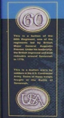
Photographed By Mike Stroud
5. The Battle of Savannah picture
This [ upper ] is a button of the
60th Regiment, one of the
regiments led by the British
Major General Augustin
Provost. Under his leadership,
the British improved and built
redoubts around Savannah in 1779.
This [lower] is a button worn by soldiers in the U.S. Continental Army. Some of these troops fought in the Battle of Savannah.
This [lower] is a button worn by soldiers in the U.S. Continental Army. Some of these troops fought in the Battle of Savannah.
Credits. This page was last revised on February 8, 2023. It was originally submitted on April 24, 2009, by Mike Stroud of Bluffton, South Carolina. This page has been viewed 8,913 times since then and 65 times this year. Last updated on January 5, 2022, by Carl Gordon Moore Jr. of North East, Maryland. Photos: 1. submitted on April 24, 2009, by Mike Stroud of Bluffton, South Carolina. 2, 3. submitted on August 10, 2013, by Bill Coughlin of Woodland Park, New Jersey. 4, 5, 6, 7, 8. submitted on April 24, 2009, by Mike Stroud of Bluffton, South Carolina. • Mark Hilton was the editor who published this page.
