Bristol in Sullivan County, Tennessee — The American South (East South Central)
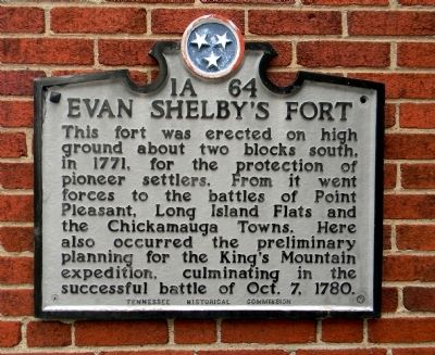
Evan Shelby's Fort
This fort was erected on high ground about two blocks south, in 1771, for the protection of the pioneer settlers. From it went forces to the battles of Point Pleasant, Long Island Flats and Chickamauga Towns. Here also occurred the preliminary planning for the King’s Mountain expedition, culminating in the successful battle of Oct. 7, 1780.
Erected by Tennessee Historical Commission. (Marker Number 1A 64.)
Topics and series. This historical marker is listed in these topic lists: Forts and Castles • Settlements & Settlers • War, US Revolutionary. In addition, it is included in the Tennessee Historical Commission series list. A significant historical year for this entry is 1771.
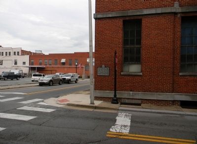
Location. 36° 35.628′ N, 82° 11.105′ W. Marker is in Bristol, Tennessee, in Sullivan County. Marker is at the intersection of 7th Street and Shelby Street, on the right when traveling north on 7th Street. Touch for map. Marker is in this post office area: Bristol TN 37620, United States of America. Touch for directions.
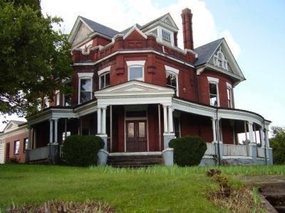
Other nearby markers. At least 8 other markers are within walking distance of this marker. The E.W. King Building (within shouting distance of this marker); Isaac Shelby (1750-1826) (within shouting distance of this marker); Bristol Tennessee Post Office & Custom House (within shouting distance of this marker); Shelby's Fort (about 700 feet away, measured in a direct line); Birthplace of Country Music (about 700 feet away); Cathy DeCaterina (approx. 0.2 miles away); Ralph S. Peer (approx. 0.2 miles away); Gammon Mansion (approx. 0.2 miles away). Touch for a list and map of all markers in Bristol.
Related marker. Click here for another marker that is related to this marker. To better understand the relationship, study the marker shown.
Also see . . . Shelby's Fort and Squabble State, a TNGenWeb Land History Report. Land of Our Ancestors website entry (Submitted on August 9, 2011, by PaulwC3 of Northern, Virginia.)
Credits. This page was last revised on August 13, 2023. It was originally submitted on August 8, 2011, by PaulwC3 of Northern, Virginia. This page has been viewed 1,188 times since then and 45 times this year. Last updated on May 5, 2015, by J. Makali Bruton of Accra, Ghana. Photos: 1, 2. submitted on August 8, 2011, by PaulwC3 of Northern, Virginia. 3. submitted on October 1, 2009, by Stanley and Terrie Howard of Greer, South Carolina. • Andrew Ruppenstein was the editor who published this page.


