4 entries match your criteria.
Related Historical Markers
To better understand the relationship, study each marker shown.
By Paul Crumlish, May 8, 2010
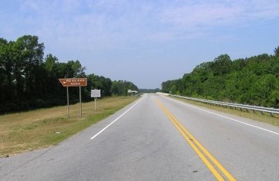
Wide view of the Welsh Neck Settlement Marker
SHOWN IN SOURCE-SPECIFIED ORDER
| | Welsh Baptists from Pennsylvania and Delaware settled on the east bank of the Pee Dee as early as 1737. Most of the lands in the Welsh Neck, from Crooked Creek to Hunt's Bluff, had been granted by 1746. A Baptist congregation was organized in 1738. . . . — — Map (db m31760) HM |
| | Marker Front: Colonel Abel Kolb was a prominent Revolutionary War Patriot of this area. A band of Tory raiders, on the night of April 27-28, 1781, surrounded the home of Colonel Kolb and his family. He was shot while surrendering himself as a . . . — — Map (db m31745) HM |
| | Marker Front: In 1788, this Baptist congregation, a branch of Cashaway Church (1756) founded by Welsh Neck Church (1738), purchased land 2 miles SW of here from the Rev. John Brown. The congregation was independently constituted in 1789 and . . . — — Map (db m31669) HM |
| | In 1788, this Baptist congregation, while still a branch of Cashaway Church (1756), purchased this land from the Rev. John Brown. The branch became an independently constituted church in 1789 named Muddy Creek and by 1829 was known as Brownsville. . . . — — Map (db m31691) HM |
May. 4, 2024