5 entries match your criteria.
Related Historical Markers
To better understand the relationship, study each marker listed here.
By Brandon Fletcher, June 1, 2013
Illustration Map
SHOWN IN SOURCE-SPECIFIED ORDER
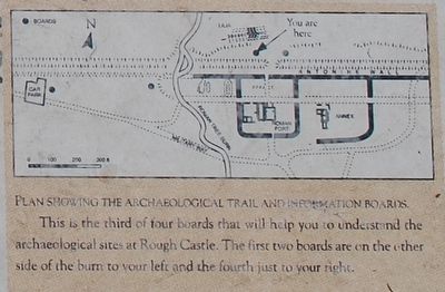
| | From where you are standing, most of the defences of the Roman fort of Rough Castle are behind you. In front of you are the remains of a system of Roman pits which were re-excavated in 1903 and have since been kept open. These originally consisted . . . — — Map (db m86757) HM |
| | The Antonine Wall was built by the Roman army in the 140's AD on the orders of the Emperor Antoninus Pius. For 20 years or more, the Wall was the north west frontier of the Roman Empire. It ran for 40 miles (64 km) from modern Bo'ness on the Forth . . . — — Map (db m86748) HM |
| | The Antonine Wall was built by the Roman Emperor Antoninus Pius AD 142-143.
It ran for 37 miles from Bridgeness on the Forth to Old Kilpatrick on the Clyde and consisted of a ditch with a turf rampart behind it.
The material from the ditch . . . — — Map (db m86741) HM |
| | The Antonine Wall was built by the Roman Army
on the orders of Emperor Antoninus Pius in the
140's AD. The Antonine Wall replaced Hadrian's
Wall as the far northern frontier of the Roman
Empire at this time, and ran for 40 Roman miles
(60km) . . . — — Map (db m86607) HM |
| | Immediately in front you can see the Antonine Wall ditch, which forms the northern defences of the Roman fort. The drawing is a bird's-eye view of the site from this position, showing the Roman fort and annex as they would have appeared during . . . — — Map (db m86758) HM |
Apr. 26, 2024