Marker Logo HMdb.org THE HISTORICAL
MARKER DATABASE
“Bite-Size Bits of Local, National, and Global History”


4 entries match your criteria.  


Historical Markers in Nanaimo, British Columbia

 
Harry Manson (seated, second from right) image, Touch for more information
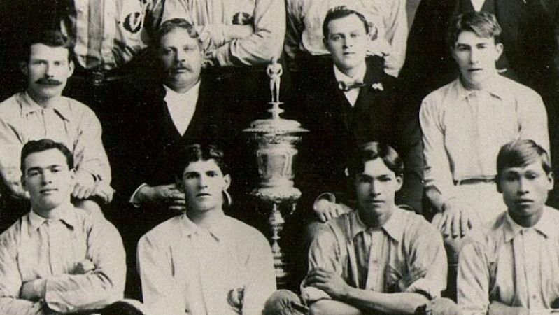
Unknown via British Columbia Archives (Public domain), 1910
Harry Manson (seated, second from right)
1 British Columbia, Nanaimo — Harry Manson
On Irwin Street, 0.2 kilometers north of Farquhar Street, on the left when traveling north.
2 British Columbia, Nanaimo — No. 1 Mine
On Front Street at Museum Way, on the right when traveling south on Front Street.
3 British Columbia, Nanaimo — Wellington
On Island Highway N, 0.4 kilometers north of Norwell Drive, on the right when traveling north.
4 British Columbia, Nanaimo, Parksville — Early Anglicans
Near Church Road south of Wembley Road, on the left when traveling south.


CeraNet Cloud Computing sponsors the Historical Marker Database.
This website earns income from purchases you make after using our links to Amazon.com. We appreciate your support.
Paid Advertisement
May. 4, 2024