On Okanagan Highway (Provincial Highway 97) 0.3 kilometers east of St. Annies Road, on the left when traveling south.
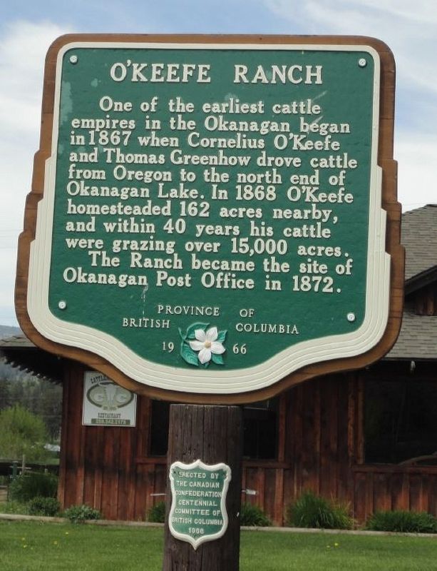
One of the earliest cattle empires in the Okanagan began in 1867 when Cornelius O'Keefe and Thomas Greenhow drove cattle from Oregon to the north end of Okanagan Lake. In 1868 O'Keefe homesteaded 162 acres nearby, and within 40 years his cattle were . . . — — Map (db m187981) HM
On Vernon-Sicamous Highway (Provincial Highway 97A) just west of Creamery Road, on the left when traveling west.
“And our eyes feasted on the
long stretch of prairies…” wrote
A. L. Fortune, first settler in
this fertile valley, in June, 1866.
The natural meadows, rippling in
tall grasses, were ideal pasture
for cattle and sheep. Later, grain
replaced . . . — — Map (db m187929) HM
On Kalamalka Lakeview Drive, 0.3 kilometers south of Okanagan Highway (Provincial Highway 97), on the left when traveling south.
The valley's potential was seen by Forbes and Charles Vernon in 1863, when travelling to silver claim staking 40 miles to the east. In 1864, the brothers pre-empted across the lake 1000 fertile acres which became Coldstream Ranch. Its products . . . — — Map (db m188020) HM
On Okanagan Highway east of The Hook, on the right when traveling east.
Trumpets first sounded here in 1908 calling the Okanagan's cavalry to muster. Joined by infantry battalions, thousands of militiamen and cadets from all over the province came to know Mission Hill as British Columbia's largest military camp. . . . — — Map (db m187949) HM