4 entries match your criteria.
Historical Markers in North Okanagan, British Columbia
By B.C. Ministry of Transportation and Infrastructure via Flickr (CC BY-NC-ND 2.0), June 15, 2016
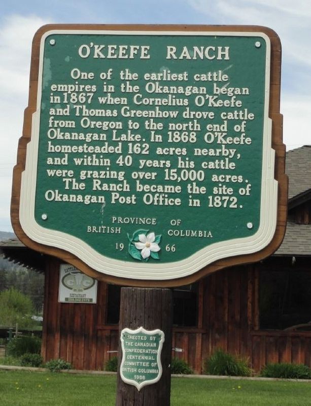
O'Keefe Ranch Marker
| On Okanagan Highway (Provincial Highway 97) 0.3 kilometers east of St. Annies Road, on the left when traveling south. |
| On Vernon-Sicamous Highway (Provincial Highway 97A) just west of Creamery Road, on the left when traveling west. |
| On Kalamalka Lakeview Drive, 0.3 kilometers south of Okanagan Highway (Provincial Highway 97), on the left when traveling south. |
| On Okanagan Highway east of The Hook, on the right when traveling east. |
May. 4, 2024