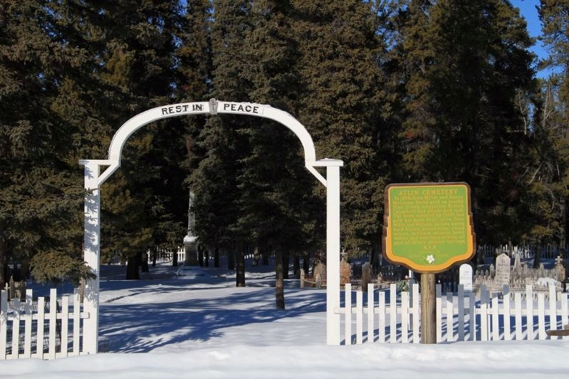
On Surprise Lake Road, 1.3 kilometers north of Warm Bay Road, on the left when traveling north.
In 1898, Fritz Miller and Kenny McLaren found gold on nearby Pine Creek, triggering British Columbia's last placer gold rush. The boom subsided by 1908, but gold has kept Atlin alive. Now Miller and McLaren lie here among hard bitten prospectors, . . . — — Map (db m188029) HM
On Dease Lake Highway/Stewart-Cassiar Highway (Provincial Highway 37) 7.2 kilometers west of Good Hope Lake Band Road, on the left when traveling west.
The prospect of quick riches lured hundreds of placer miners to the Cassiar, where gold was discovered first at Dease Creek in 1872. Rich claims were later found at Thibert Creek and here at McDame Creek. From this creek in 1877 a 72-ounce solid . . . — — Map (db m187916) HM