Near Clayhall Road, 1.1 kilometers east of Haslar Road, on the right when traveling north.
An "A" Class Submarine
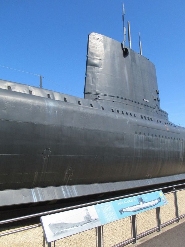
HMS Alliance was one of 16 "A" Class submarines designed during the Second World War and intended for use in the Far East. Measuring 28l feet long, Alliance displaced 1,620 tons when submerged and could dive . . . — — Map (db m123320) HM
Near Clayhall Road, 1.1 kilometers east of Haslar Road, on the right when traveling north.
To Commemorate the Unveiling of
the Conning Tower of HM Submarine E17
on 24 November 1989
by
the Earl of Erroll
Descendent of the Commanding Officer
Sir Guy Moncreiffe Thatilk — — Map (db m123323) HM
Near Clayhall Road, 1.1 kilometers east of Haslar Road, on the right when traveling north.
Those who died in RN Submarines
( the memorial lists the names of all men who died serving aboard submarines in the Royal Navy) — — Map (db m123324) WM
Near Clayhall Road, 1.1 kilometers east of Haslar Road when traveling north.
To the Memory of
The Young Men of the XIIth Submarine Flotilla
Who Lost Their Lives
In The Second World War
1939-1945
That You and I Might Live
In Freedom and Peace
Their Names Are Inscribed on a Scroll in the Museum
We Shall See, . . . — — Map (db m123325) WM