3 entries match your criteria.
Related Historical Markers
By Duane Hall, June 4, 2015
Chickasaw Council House Marker
SHOWN IN SOURCE-SPECIFIED ORDER
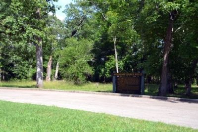
| On Natchez Trace Parkway (at milepost 251.1), 0.5 miles south of Pontocola Road (County Road 506), on the right when traveling north. |
| | Westerly on the Natchez Trace stood an Indian village “Pontatock” with its council house which, in the 1820's, became the “Capitol” of the Chickasaw Nation.
The chiefs and headmen met there to sign treaties or to . . . — — Map (db m84817) HM |
| On Black Zion Road (Mississippi Route 342) at Valley Road (County Road 853), on the right when traveling north on Black Zion Road. |
| | One mile southeast, near the original Natchez Trace, was the National Council House of the Chickasaws. There, Oct. 20, 1832, the Pontotoc Creek Treaty was signed, ceding to the United States over six million acres. — — Map (db m102691) HM |
| On South Main Street at East Marion Street, on the right when traveling north on South Main Street. |
| | S.E. about 7 miles is site of council house where on October 20, 1832, treaty was signed providing for cession of over 6 million acres to U.S. and removal of Chickasaws to West. — — Map (db m102702) HM |
May. 5, 2024